
Search
Search Results
Image
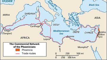
Phoenician Trade Network
Map of Phoenicia and its trade routes.

Image
The East India Company Trade, c. 1800
A map illustrating the markets and goods traded by the East India Company (EIC) with East and Southeast Asia and India around 1800. Incorporated on December 31, 1600, by Queen Elizabeth I's Royal Charter, it was given an initial 15-year monopoly...
Image
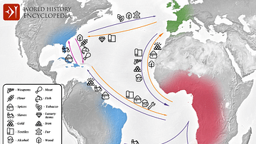
Transatlantic Triangular Trade Map
Map showing the flow of goods and enslaved people across the Atlantic between Europe, Africa and America in the transatlantic triangular trade which the European colonial powers operated from the 16th to the 19th centuries CE. This triangular...
Image
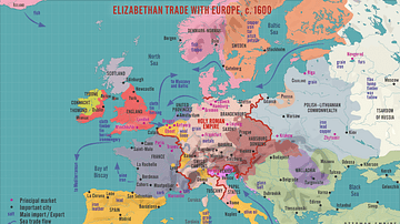
Elizabethan Trade with Europe, c. 1600
A map illustrating the flourishing English trade with Europe during the reign of Queen Elizabeth I of England (r. 1558-1603). Following the abolishment of the Hanseatic merchants' Baltic monopoly, access to a new commodities market in Amsterdam...
Image
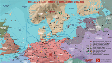
The Hanseatic League - Trade in the North and Baltic Seas c. 1400
A map illustrating the expanse and complexity of the northern Europen trade network of commerce and the powerful association of cities and merchant guilds known as the Hanseatic League (from Old High German - Hanse for “guild,” or “association,”...
Image
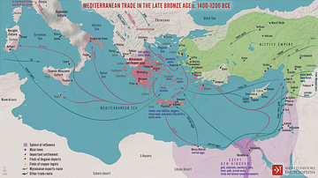
Mediterranean Trade in the Late Bronze Age c. 1400-1200 BCE
A map illustrating the late Bronze Age trade in the eastern Mediterranean seaboard as a region of increasing connectivity between the key players Pharaonic Egypt in the south, the Hittite Empire, Mesopotamia, and the Levant to the east, and...
Image
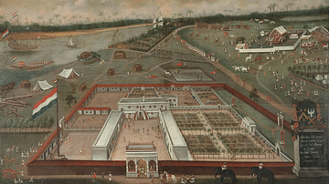
VOC Trade Lodge in Hooghly, Bengal
A 1665 painting by Hendrik van Schuylenbergh showing the Dutch East India Company (VOC) Trade Lodge in Hooghly, Bengal. (Rijksmuseum, Amsterdam)
Definition
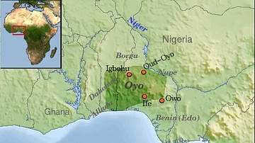
Oyo Empire
The Oyo Empire flourished from the 17th to 19th century CE in what is today southwest Nigeria. The Oyo forged an empire thanks to their formidable cavalry units and so came to dominate other Yoruba peoples of the region. The Oyo Empire, with...

Video
The Silk Road: Trade Route of the Ancient World
The Silk Road was a network of trading routes that connected a number of different regions in the ancient world, stretching over four thousand miles from China, through India and Asia Minor and through Mesopotamia and the African continent...

Video
How Roman Trade with India Made the Empire Rich
This video was sponsored by Imperator: Rome. You can support our channel by buying this game via this link: https://store.steampowered.com/app/859580/Imperator_Rome/ We are continuing our new animated historical documentary series on the...