
Illustration


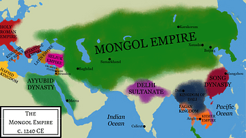
This map illustrates Marco Polo's travels (1271 - 1295), which spanned vast regions of Asia, including the Middle East, Central Asia, and China, where he served at the court of Kublai Khan. Polo journeyed along the Silk Road, encountering diverse cultures, unfamiliar landscapes, and innovations such as paper money, coal burning, and gunpowder. His detailed accounts (collected in Devisement du Monde, Description of the World, later known as Il Milione or The Travels of Marco Polo) of the wealth and grandeur of the Mongol Empire, particularly in China (referred to as Cathay), captivated European audiences and greatly influenced later explorers like Christopher Columbus
About the Author

Related Images
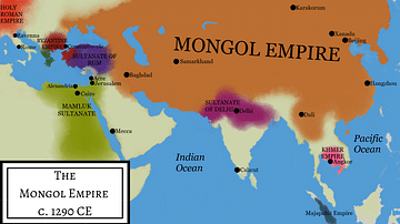
Mongol Empire Under Kublai Khan
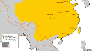
Map of Yuan Dynasty China

The Silk Road at Its Height in the Late 8th Century
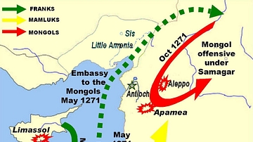
Mamluk, Frankish and Mongol Movement in 1271-2 CE
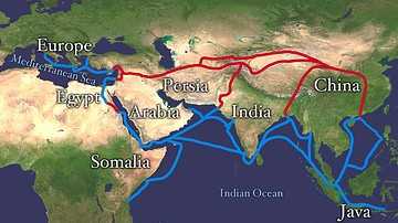
Map of the Silk Road Routes
Mongol Empire Under Ogedei Khan
Cite This Work
APA Style
Netchev, S. (2019, February 11). Map of Marco Polo’s Travels, 1271 - 1295. World History Encyclopedia. Retrieved from https://www.worldhistory.org/image/10041/map-of-marco-polos-travels-1271---1295/
Chicago Style
Netchev, Simeon. "Map of Marco Polo’s Travels, 1271 - 1295." World History Encyclopedia. Last modified February 11, 2019. https://www.worldhistory.org/image/10041/map-of-marco-polos-travels-1271---1295/.
MLA Style
Netchev, Simeon. "Map of Marco Polo’s Travels, 1271 - 1295." World History Encyclopedia. World History Encyclopedia, 11 Feb 2019, https://www.worldhistory.org/image/10041/map-of-marco-polos-travels-1271---1295/. Web. 09 May 2025.