
Illustration


A map of the east coast of Africa showing, amongst others, the key trade ports of the Swahili Coast during the medieval period, 12th to 15th century CE.
License & Copyright
 Based on Wikipedia content that has been reviewed, edited, and republished.
Original image by Walrasiad. Uploaded by Mark Cartwright, published on 27 March 2019. The copyright holder has published this content under the following license: Creative Commons Attribution. This license lets others distribute, remix, tweak, and build upon your work, even commercially, as long as they credit you for the original creation. When republishing on the web a hyperlink back to the original content source URL must be included. Please note that content linked from this page may have different licensing terms.
Based on Wikipedia content that has been reviewed, edited, and republished.
Original image by Walrasiad. Uploaded by Mark Cartwright, published on 27 March 2019. The copyright holder has published this content under the following license: Creative Commons Attribution. This license lets others distribute, remix, tweak, and build upon your work, even commercially, as long as they credit you for the original creation. When republishing on the web a hyperlink back to the original content source URL must be included. Please note that content linked from this page may have different licensing terms.
Related Images
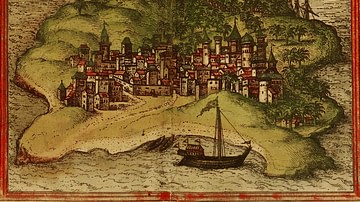
Kilwa Map Illustration
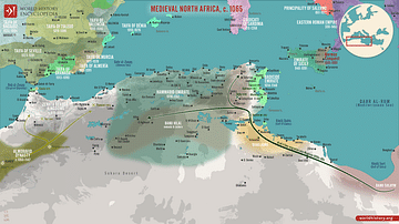
Map of Medieval North Africa, c. 1065
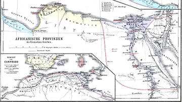
Map of Roman Africa
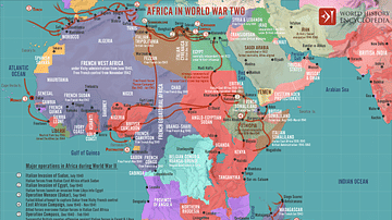
Africa in World War Two
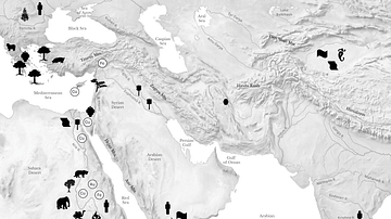
Resource Map of the Ancient Middle East
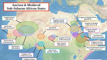
Map of Ancient & Medieval Sub-Saharan African States
Cite This Work
APA Style
Walrasiad. (2019, March 27). Swahili Coast Map. World History Encyclopedia. Retrieved from https://www.worldhistory.org/image/10327/swahili-coast-map/
Chicago Style
Walrasiad. "Swahili Coast Map." World History Encyclopedia. Last modified March 27, 2019. https://www.worldhistory.org/image/10327/swahili-coast-map/.
MLA Style
Walrasiad. "Swahili Coast Map." World History Encyclopedia. World History Encyclopedia, 27 Mar 2019, https://www.worldhistory.org/image/10327/swahili-coast-map/. Web. 19 Apr 2025.