
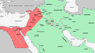
Illustration


A map depicting the divisions of the Islamic Empire during the second Islamic civil war - the Second Fitna. The dominions of the Umayyads, Zubayrids, Kharjites, Al Mukhtar and those regained by the Byzantines are shaded in colors as indicated by the key.
License & Copyright
 Based on Wikipedia content that has been reviewed, edited, and republished.
Original image by Al Ameer son. Uploaded by Syed Muhammad Khan, published on 07 January 2020. The copyright holder has published this content under the following license: Creative Commons Attribution-NonCommercial-ShareAlike. This license lets others remix, tweak, and build upon this content non-commercially, as long as they credit the author and license their new creations under the identical terms. When republishing on the web a hyperlink back to the original content source URL must be included. Please note that content linked from this page may have different licensing terms.
Based on Wikipedia content that has been reviewed, edited, and republished.
Original image by Al Ameer son. Uploaded by Syed Muhammad Khan, published on 07 January 2020. The copyright holder has published this content under the following license: Creative Commons Attribution-NonCommercial-ShareAlike. This license lets others remix, tweak, and build upon this content non-commercially, as long as they credit the author and license their new creations under the identical terms. When republishing on the web a hyperlink back to the original content source URL must be included. Please note that content linked from this page may have different licensing terms.
Related Images
Map of the First Fitna
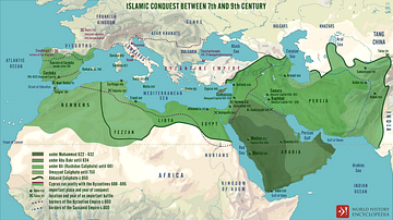
Islamic Conquests in the 7th-9th Centuries
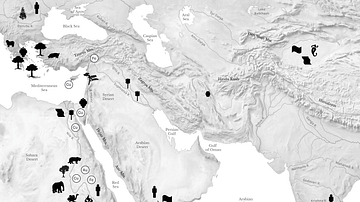
Resource Map of the Ancient Middle East
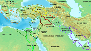
Map of the ancient Near East during the Amarna Period
Territories During the Second Punic War

The Roman Empire during the Flavian Dynasty, 69 - 96 CE
Cite This Work
APA Style
son, A. A. (2020, January 07). Map of the Middle East during the Second Fitna (c. 686 CE). World History Encyclopedia. Retrieved from https://www.worldhistory.org/image/11657/map-of-the-middle-east-during-the-second-fitna-c-6/
Chicago Style
son, Al Ameer. "Map of the Middle East during the Second Fitna (c. 686 CE)." World History Encyclopedia. Last modified January 07, 2020. https://www.worldhistory.org/image/11657/map-of-the-middle-east-during-the-second-fitna-c-6/.
MLA Style
son, Al Ameer. "Map of the Middle East during the Second Fitna (c. 686 CE)." World History Encyclopedia. World History Encyclopedia, 07 Jan 2020. Web. 14 Apr 2025.