
Illustration


The term "Fertile Crescent," (a term first used in 1916 by Egyptologist J.H. Breasted), describes a crescent-shaped region spanning the Eastern Mediterranean, Anatolia, and Mesopotamia—often called the "Cradle of Civilization." This area, including modern Iraq, Syria, Lebanon, Israel, Palestine, Jordan, Turkey, and western Iran, is known for its rich soils and early agricultural development. By the 9th millennium BCE, settled farming communities had emerged, cultivating wheat, barley, lentils, and peas while domesticating sheep, goats, and pigs. Advances in irrigation and farming led to surplus food production, spurring the rise of some of the world’s earliest cities.
About the Author

Related Images
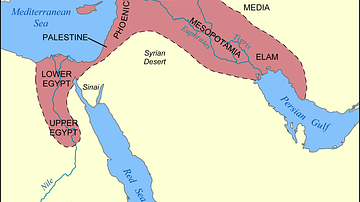
Map of the Fertile Crescent
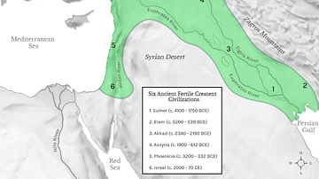
Fertile Crescent Map
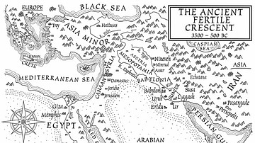
A Map of the Ancient Fertile Crescent (From the Novel The Jericho River)
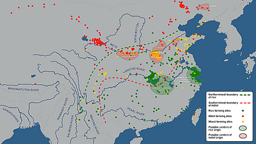
Possible Agricultural Centers in Prehistoric China
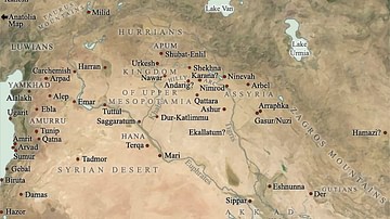
Map of Mesopotamia, 2000-1600 BCE
Map of the World from Sippar, Mesopotamia
Cite This Work
APA Style
Netchev, S. (2020, August 05). Map of the Fertile Crescent. World History Encyclopedia. Retrieved from https://www.worldhistory.org/image/12521/map-of-the-fertile-crescent/
Chicago Style
Netchev, Simeon. "Map of the Fertile Crescent." World History Encyclopedia. Last modified August 05, 2020. https://www.worldhistory.org/image/12521/map-of-the-fertile-crescent/.
MLA Style
Netchev, Simeon. "Map of the Fertile Crescent." World History Encyclopedia. World History Encyclopedia, 05 Aug 2020. Web. 13 Apr 2025.