
Illustration


Nautical chart of the North-East Atlantic Ocean, the Baltic Sea, the Mediterranean Sea and the Black Sea, accompanied by a circular world map.
Alleged author: Cristopher Columbus (l. 1451-1506 CE)
Gallica Digital Library
License & Copyright
 Based on Wikipedia content that has been reviewed, edited, and republished.
Original image by Gallica Digital Library. Uploaded by Ibolya Horváth, published on 09 October 2020. The copyright holder has published this content under the following license: Public Domain. This item is in the public domain, and can be used, copied, and modified without any restrictions. Please note that content linked from this page may have different licensing terms.
Based on Wikipedia content that has been reviewed, edited, and republished.
Original image by Gallica Digital Library. Uploaded by Ibolya Horváth, published on 09 October 2020. The copyright holder has published this content under the following license: Public Domain. This item is in the public domain, and can be used, copied, and modified without any restrictions. Please note that content linked from this page may have different licensing terms.
Related Images
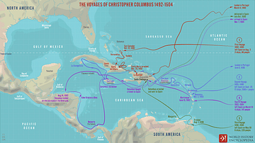
The Voyages of Christopher Columbus 1492-1504
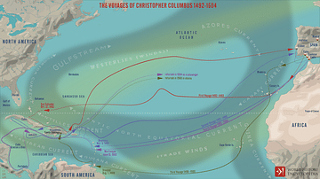
The Four Voyages of Christopher Columbus
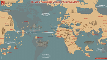
The World According to Columbus c. 1490
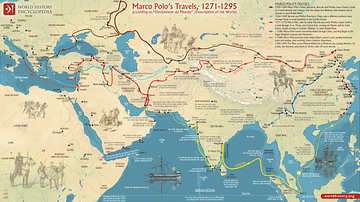
Map of Marco Polo’s Travels, 1271 - 1295
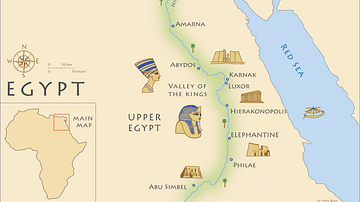
Map of Ancient Egypt
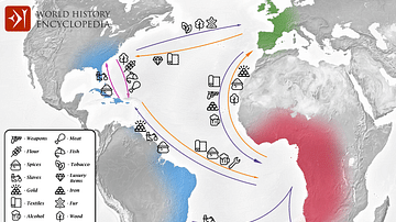
Transatlantic Triangular Trade Map
Cite This Work
APA Style
Library, G. D. (2020, October 09). 15-century CE Nautical Map. World History Encyclopedia. Retrieved from https://www.worldhistory.org/image/12877/15-century-ce-nautical-map/
Chicago Style
Library, Gallica Digital. "15-century CE Nautical Map." World History Encyclopedia. Last modified October 09, 2020. https://www.worldhistory.org/image/12877/15-century-ce-nautical-map/.
MLA Style
Library, Gallica Digital. "15-century CE Nautical Map." World History Encyclopedia. World History Encyclopedia, 09 Oct 2020. Web. 27 Mar 2025.