Illustration
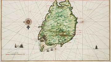
A 1598 map of the Portuguese colony of Cape Verde, an archipelago in the Central Atlantic off the coast of West Africa. Drawn by Barent Langenes. (National Library of France, Paris)
Cite This Work
APA Style
Langenes, B. (2021, May 25). Historical Map of the Cape Verde Islands. World History Encyclopedia. Retrieved from https://www.worldhistory.org/image/14106/historical-map-of-the-cape-verde-islands/
Chicago Style
Langenes, Barent. "Historical Map of the Cape Verde Islands." World History Encyclopedia. Last modified May 25, 2021. https://www.worldhistory.org/image/14106/historical-map-of-the-cape-verde-islands/.
MLA Style
Langenes, Barent. "Historical Map of the Cape Verde Islands." World History Encyclopedia. World History Encyclopedia, 25 May 2021, https://www.worldhistory.org/image/14106/historical-map-of-the-cape-verde-islands/. Web. 24 Apr 2025.


