
Illustration


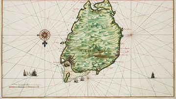
A 1598 map of the Portuguese colony of Cape Verde, an archipelago in the Central Atlantic off the coast of West Africa. Drawn by Barent Langenes. (National Library of France, Paris)
License & Copyright
 Based on Wikipedia content that has been reviewed, edited, and republished.
Original image by Barent Langenes. Uploaded by Mark Cartwright, published on 25 May 2021. The copyright holder has published this content under the following license: Public Domain. This item is in the public domain, and can be used, copied, and modified without any restrictions. Please note that content linked from this page may have different licensing terms.
Based on Wikipedia content that has been reviewed, edited, and republished.
Original image by Barent Langenes. Uploaded by Mark Cartwright, published on 25 May 2021. The copyright holder has published this content under the following license: Public Domain. This item is in the public domain, and can be used, copied, and modified without any restrictions. Please note that content linked from this page may have different licensing terms.
Related Images

Portuguese Colonial Empire in the Age of Exploration
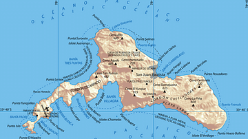
Juan Fernández Islands
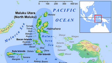
Maluku Islands in Indonesia
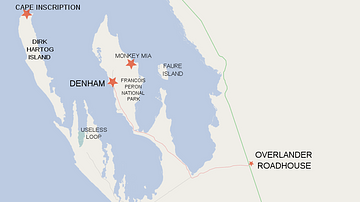
Map of Shark Bay Area Showing Dirk Hartog Island and Cape Inscription
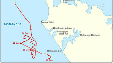
The Route of the St Jean Baptiste and the Endeavour around the North Cape of New Zealand
Historical Map of São Tomé
Cite This Work
APA Style
Langenes, B. (2021, May 25). Historical Map of the Cape Verde Islands. World History Encyclopedia. Retrieved from https://www.worldhistory.org/image/14106/historical-map-of-the-cape-verde-islands/
Chicago Style
Langenes, Barent. "Historical Map of the Cape Verde Islands." World History Encyclopedia. Last modified May 25, 2021. https://www.worldhistory.org/image/14106/historical-map-of-the-cape-verde-islands/.
MLA Style
Langenes, Barent. "Historical Map of the Cape Verde Islands." World History Encyclopedia. World History Encyclopedia, 25 May 2021, https://www.worldhistory.org/image/14106/historical-map-of-the-cape-verde-islands/. Web. 06 May 2025.