
Illustration


The "Cotton Map" is an Anglo-Saxon map of the world produced during the 12th Century. The map is oriented with East at the top, and West at the bottom, in the style of many Medieval maps. The Anglo-Saxon map is sometimes called the "Cotton Map" after Cotton MS Tiberius B.V., the manuscript in which it is drawn. (Courtesy of the British Library)
Related Images
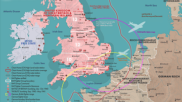
Map of the Battle of Britain, 1940
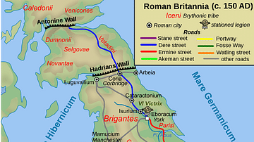
Map of Roman Britain, 150 AD

Royal House of Hanover in Britain Family Tree
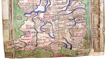
Matthew Paris' Map of Britain

Norman Conquest of Britain, 1066 - 1086
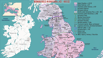
Roman Rule in Britain c. 43 - 410 CE
Cite This Work
APA Style
Library, B. (2021, May 30). Anglo-Saxon Map of the World. World History Encyclopedia. Retrieved from https://www.worldhistory.org/image/14124/anglo-saxon-map-of-the-world/
Chicago Style
Library, British. "Anglo-Saxon Map of the World." World History Encyclopedia. Last modified May 30, 2021. https://www.worldhistory.org/image/14124/anglo-saxon-map-of-the-world/.
MLA Style
Library, British. "Anglo-Saxon Map of the World." World History Encyclopedia. World History Encyclopedia, 30 May 2021. Web. 15 Apr 2025.