
Illustration


The Da Ming Hunyi Tu is a Chinese world map made c. 1389, during the Ming Dynasty. The map, which replicates the curvature of the Earth, centers on China but also includes Africa and Europe. 386 (151.9 in) x 456 cm (175.9). Paint on silk. First Historical Archive of China, Beijing.
License & Copyright
 Based on Wikipedia content that has been reviewed, edited, and republished.
Original image by David Trochos. Uploaded by Arienne King, published on 30 May 2021. The copyright holder has published this content under the following license: Creative Commons Attribution-NonCommercial-ShareAlike. This license lets others remix, tweak, and build upon this content non-commercially, as long as they credit the author and license their new creations under the identical terms. When republishing on the web a hyperlink back to the original content source URL must be included. Please note that content linked from this page may have different licensing terms.
Based on Wikipedia content that has been reviewed, edited, and republished.
Original image by David Trochos. Uploaded by Arienne King, published on 30 May 2021. The copyright holder has published this content under the following license: Creative Commons Attribution-NonCommercial-ShareAlike. This license lets others remix, tweak, and build upon this content non-commercially, as long as they credit the author and license their new creations under the identical terms. When republishing on the web a hyperlink back to the original content source URL must be included. Please note that content linked from this page may have different licensing terms.
Related Images
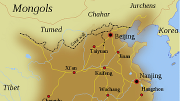
Map of the Ming Dynasty Territory
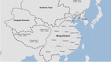
Ming Dynasty Empire, c. 1409 CE

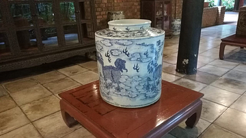
Ming Dynasty Blue-and-White Porcelain
Ming Dynasty Porcelain
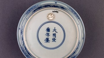
Ming Porcelain Reign Inscription
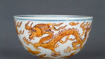
Ming Porcelain Bowl with Dragon
Cite This Work
APA Style
Trochos, D. (2021, May 30). Da Ming Hunyi Tu. World History Encyclopedia. Retrieved from https://www.worldhistory.org/image/14131/da-ming-hunyi-tu/
Chicago Style
Trochos, David. "Da Ming Hunyi Tu." World History Encyclopedia. Last modified May 30, 2021. https://www.worldhistory.org/image/14131/da-ming-hunyi-tu/.
MLA Style
Trochos, David. "Da Ming Hunyi Tu." World History Encyclopedia. World History Encyclopedia, 30 May 2021, https://www.worldhistory.org/image/14131/da-ming-hunyi-tu/. Web. 11 May 2025.