
Illustration


This map illustrates the Silk Road in the late 8th century, a vast network connecting Tang China, Central Asia, the Islamic world, and Europe. More than just a silk route, it enabled the exchange of luxury goods, technologies, and religions, becoming one of history’s most significant engines of trade, diplomacy, and cultural transmission across Eurasia.
During this period, the Tang Dynasty controlled the eastern reaches of the Silk Road, while the Abbasid Caliphate, centered in Baghdad, integrated trade into a rapidly expanding Islamic economy. The Uyghur Khaganate secured the steppe corridors linking East and West. Major cities such as Samarkand, Bukhara, Kashgar, Merv, and Nishapur thrived as commercial and intellectual hubs. From Baghdad, trade extended west through the Levant and into Byzantine territories, connecting with European markets. By the 9th century, however, shifting political dynamics and expanding maritime trade routes contributed to the gradual decline of overland commerce.
About the Author

Related Images
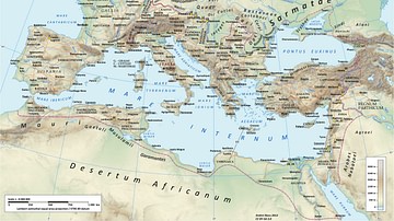
Roman Road Network
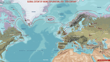
Global Extent of Viking Exploration, 8th-11th Century
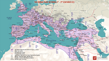
The Roman Trade Network (1st - 3rd centuries CE)
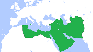
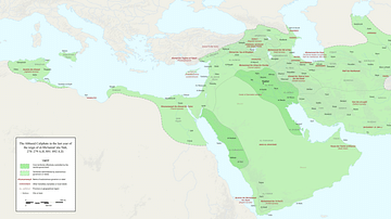
Map of the Abbasid Empire
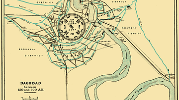
City Plan of Medieval Baghdad
Fragmentation of the Abbasid Empire (891-892 CE)
Cite This Work
APA Style
Netchev, S. (2025, February 04). The Silk Road at Its Height in the Late 8th Century. World History Encyclopedia. Retrieved from https://www.worldhistory.org/image/146/the-silk-road-at-its-height-in-the-late-8th-centur/
Chicago Style
Netchev, Simeon. "The Silk Road at Its Height in the Late 8th Century." World History Encyclopedia. Last modified February 04, 2025. https://www.worldhistory.org/image/146/the-silk-road-at-its-height-in-the-late-8th-centur/.
MLA Style
Netchev, Simeon. "The Silk Road at Its Height in the Late 8th Century." World History Encyclopedia. World History Encyclopedia, 04 Feb 2025. Web. 08 Apr 2025.