Illustration
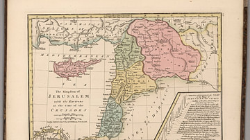
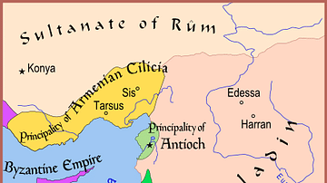
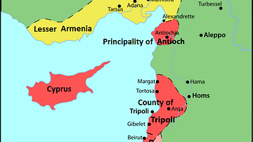
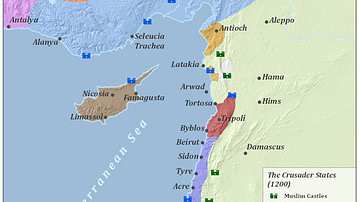
Maps illustrating the trajectory of a series of early military campaigns initiated by the medieval Church between 1096–1192, aiming at liberating the "Holy Land" (roughly located between the Mediterranean Sea and the Eastern Bank of the Jordan River) from Muslim control. Those were known as Crusades and resulted in establishing several Roman Catholic Kingdoms in the Near East (most notably - the County of Edessa, the Principality of Antioch, the County of Tripoli, and the Kingdom of Jerusalem.)
About the Author
Cite This Work
APA Style
Netchev, S. (2022, March 14). The First Three Crusades and the 12th-Century Latin East (Outremer). World History Encyclopedia. Retrieved from https://www.worldhistory.org/image/15382/the-first-three-crusades-and-the-12th-century-lati/
Chicago Style
Netchev, Simeon. "The First Three Crusades and the 12th-Century Latin East (Outremer)." World History Encyclopedia. Last modified March 14, 2022. https://www.worldhistory.org/image/15382/the-first-three-crusades-and-the-12th-century-lati/.
MLA Style
Netchev, Simeon. "The First Three Crusades and the 12th-Century Latin East (Outremer)." World History Encyclopedia. World History Encyclopedia, 14 Mar 2022, https://www.worldhistory.org/image/15382/the-first-three-crusades-and-the-12th-century-lati/. Web. 17 Apr 2025.


