


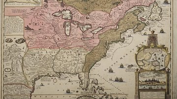
A map illustrating the route taken by King Louis XVI and his family during the failed escape from Paris known as the Flight to Varennes, on the night of 20-21 June 1791. The royal family was attempting to make it to Montmedy, on the border of the Austrian Netherlands, but was stopped and arrested at the town of Varennes-en-Argonne. From The Outline of History (New York, NY: The Macmillan Company, 1921) page 867, by H.G. Wells.
Related Images

Map of the French Revolution and Wars 1789-99
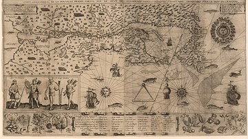
Map of New France, 1612 CE
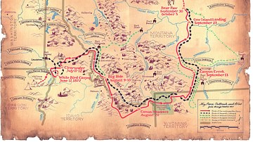
Flight of the Nez Perce and Key Battle Sites of 1877
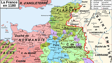
Map of 12th-Century France

Map of New France, 1750 CE
Map of New France
Cite This Work
APA Style
Wells, H. (2022, August 09). Map to Illustrate the Flight to Varennes. World History Encyclopedia. https://www.worldhistory.org/image/16241/map-to-illustrate-the-flight-to-varennes/
Chicago Style
Wells, H.G.. "Map to Illustrate the Flight to Varennes." World History Encyclopedia, August 09, 2022. https://www.worldhistory.org/image/16241/map-to-illustrate-the-flight-to-varennes/.
MLA Style
Wells, H.G.. "Map to Illustrate the Flight to Varennes." World History Encyclopedia, 09 Aug 2022, https://www.worldhistory.org/image/16241/map-to-illustrate-the-flight-to-varennes/.