
Illustration


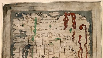
The Greek philosopher Anaximander of Miletus (l. c. 610 to c. 546 BCE) is credited with having drawn the first map of the world, which was circular in form and showed the three continents of Europe, Asia and Libya (Africa) surrounded by the great world ocean. The Phasis River (now known as the Rioni River) was the dividing line between Europe and Asia, and the Nile River was the dividing line between Africa and Asia.
License & Copyright
 Based on Wikipedia content that has been reviewed, edited, and republished.
Original image by Bibi Saint-Pol. Uploaded by Carole Raddato, published on 07 December 2023. The copyright holder has published this content under the following license: Public Domain. This item is in the public domain, and can be used, copied, and modified without any restrictions. Please note that content linked from this page may have different licensing terms.
Based on Wikipedia content that has been reviewed, edited, and republished.
Original image by Bibi Saint-Pol. Uploaded by Carole Raddato, published on 07 December 2023. The copyright holder has published this content under the following license: Public Domain. This item is in the public domain, and can be used, copied, and modified without any restrictions. Please note that content linked from this page may have different licensing terms.
Related Images
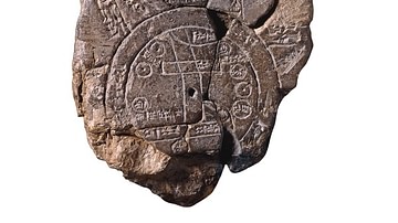
Babylonian Map of the World
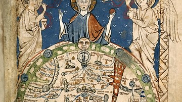
Psalter World Map
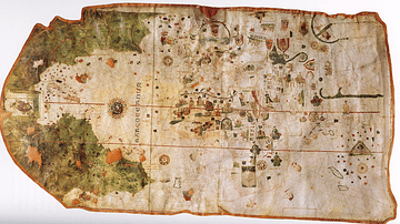
Map of the World by Juan de la Cosa
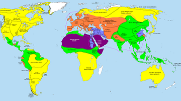
Map of the World in 1000 BCE
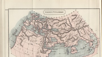
Map of the Ptolemaic World
Anglo-Saxon Map of the World
Cite This Work
APA Style
Saint-Pol, B. (2023, December 07). Anaximander World Map. World History Encyclopedia. Retrieved from https://www.worldhistory.org/image/18224/anaximander-world-map/
Chicago Style
Saint-Pol, Bibi. "Anaximander World Map." World History Encyclopedia. Last modified December 07, 2023. https://www.worldhistory.org/image/18224/anaximander-world-map/.
MLA Style
Saint-Pol, Bibi. "Anaximander World Map." World History Encyclopedia. World History Encyclopedia, 07 Dec 2023, https://www.worldhistory.org/image/18224/anaximander-world-map/. Web. 21 Apr 2025.