Illustration
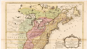
A map showing the extermination of the American bison to 1889, based on a drawing by conservationist and zoologist William Temple Hornaday. Light brown indicates the original range; brown suggests the range as of 1870; small black areas are the range as of 1889.
Cite This Work
APA Style
Hornaday, C. /. W. T. (2024, January 18). Map of the Extermination of the Bison. World History Encyclopedia. Retrieved from https://www.worldhistory.org/image/18354/map-of-the-extermination-of-the-bison/
Chicago Style
Hornaday, Cephas / William Temple. "Map of the Extermination of the Bison." World History Encyclopedia. Last modified January 18, 2024. https://www.worldhistory.org/image/18354/map-of-the-extermination-of-the-bison/.
MLA Style
Hornaday, Cephas / William Temple. "Map of the Extermination of the Bison." World History Encyclopedia. World History Encyclopedia, 18 Jan 2024, https://www.worldhistory.org/image/18354/map-of-the-extermination-of-the-bison/. Web. 18 Apr 2025.


