Illustration
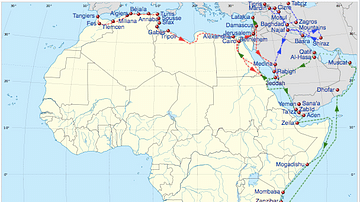
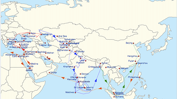
A map tracing the extraordinary journeys of Ibn Battuta (1304–c.1368), a 14th-century Maghrebi explorer and Islamic scholar born in Tangier. Over nearly three decades, he traveled 75,000 miles (120,000 km) across the Islamic world and beyond — from Morocco and Mali to India, China, and the Maldives — recording his experiences in The Rihla (Arabic: رحلة, Journey).
His travel account remains one of the most detailed and valuable windows into the medieval world. Unlike Marco Polo, Ibn Battuta was not just an observer but deeply immersed in the societies he visited — often serving as a judge (qadi), advisor, or guest of rulers. This gave him unique access to courts, cities, and everyday life from North Africa to Southeast Asia.
Battuta’s Rihla captures the rich tapestry of the 14th-century Islamic world: bustling trade cities, diverse religious practices, and complex political intrigues. He writes of the gold-laden Mali Empire, the scholar-filled streets of Mamluk-ruled Cairo, the splendor of the Sultanate of Delhi, and the chaos of pirate attacks in the Indian Ocean. He also travelled to Constantinople, witnessing the vibrant crossroads of Byzantine and Islamic cultures, and marveled at the splendor of China’s Yuan dynasty.
More than a travelogue, The Rihla is a chronicle of the medieval world's interconnectedness — a reminder that centuries before globalization, vast trade, faith, and diplomacy networks linked distant societies.
About the Author
External Links
Cite This Work
APA Style
Netchev, S. (2024, May 09). Ibn Battuta’s Travels, 1325-1354. World History Encyclopedia. Retrieved from https://www.worldhistory.org/image/18929/ibn-battutas-travels-1325-1354/
Chicago Style
Netchev, Simeon. "Ibn Battuta’s Travels, 1325-1354." World History Encyclopedia. Last modified May 09, 2024. https://www.worldhistory.org/image/18929/ibn-battutas-travels-1325-1354/.
MLA Style
Netchev, Simeon. "Ibn Battuta’s Travels, 1325-1354." World History Encyclopedia. World History Encyclopedia, 09 May 2024. Web. 14 Apr 2025.


