
Illustration


The First Crusade (1096–1099) was a pivotal military expedition initiated by Western European Christians in response to Pope Urban II’s call at the Council of Clermont in 1095. Aimed at reclaiming Jerusalem and other holy sites in the Levant from Muslim control, the Crusade was driven by a combination of religious zeal, desire for adventure, and political motives. Led by prominent nobles and knights, thousands of Crusaders journeyed through Europe and Asia Minor, overcoming numerous challenges and engaging in key battles such as the Siege of Antioch. In 1099, the Crusaders successfully captured Jerusalem, establishing several Crusader states in the region. The First Crusade significantly impacted Christian-Muslim relations, European expansion, and the geopolitical landscape of the Middle East, setting the stage for subsequent Crusades and enduring historical consequences.
About the Author

Related Images
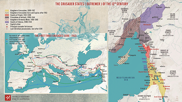
The First Three Crusades and the 12th-Century Latin East (Outremer)
Map of the Crusader States, 1229-1240 CE
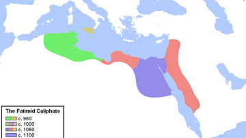
Expansion of the Fatimid Caliphate
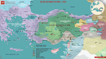
The Seljuk Sultanate of Rum, c. 1200
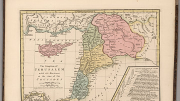
Kingdom of Jerusalem at the Time of the Crusades
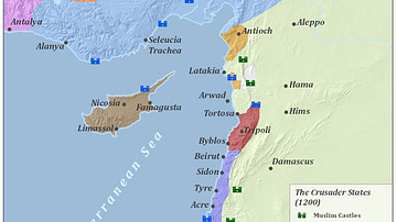
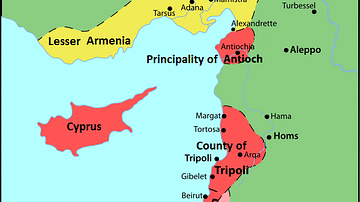
Crusader States 1200 CE
Cite This Work
APA Style
Netchev, S. (2024, September 11). Map of the First Crusade, 1096 - 1099. World History Encyclopedia. Retrieved from https://www.worldhistory.org/image/19429/map-of-the-first-crusade-1096---1099/
Chicago Style
Netchev, Simeon. "Map of the First Crusade, 1096 - 1099." World History Encyclopedia. Last modified September 11, 2024. https://www.worldhistory.org/image/19429/map-of-the-first-crusade-1096---1099/.
MLA Style
Netchev, Simeon. "Map of the First Crusade, 1096 - 1099." World History Encyclopedia. World History Encyclopedia, 11 Sep 2024. Web. 13 Apr 2025.