
Illustration


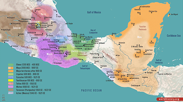
This map illustrates the rise and extent of the Olmec civilization, which flourished from around 1200 to 400 BCE (the earliest Olmec finds near the San Lorenzo Tenochtitlán sites, date back to c.1600) in the present-day Gulf Coast in the Mexican states of Veracruz and Tabasco. It is considered the "mother culture" of Mesoamerica. This early civilization laid the foundation for later societies like the Maya, Zapotec, and Aztecs through its innovations in architecture, agriculture, writing, and religion. Their extensive trade networks helped spread goods like obsidian, jade, and cacao, as well as their cultural practices, far beyond their territory.
The Olmec are best known for their colossal stone heads, intricate jade carvings, and ceremonial centers such as La Venta and San Lorenzo.
About the Author

Related Images
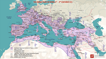
The Roman Trade Network (1st - 3rd centuries CE)
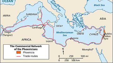
Phoenician Trade Network
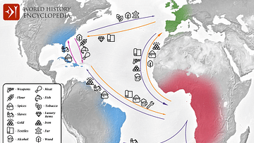
Transatlantic Triangular Trade Map
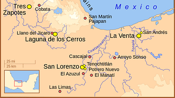
Principal Olmec Settlements
Mesoamerican Civilizations Map
Trade in the Roman Empire Map (c. 200 CE)
Cite This Work
APA Style
Netchev, S. (2024, September 30). Map of the Olmec Civilization. World History Encyclopedia. Retrieved from https://www.worldhistory.org/image/19490/map-of-the-olmec-civilization/
Chicago Style
Netchev, Simeon. "Map of the Olmec Civilization." World History Encyclopedia. Last modified September 30, 2024. https://www.worldhistory.org/image/19490/map-of-the-olmec-civilization/.
MLA Style
Netchev, Simeon. "Map of the Olmec Civilization." World History Encyclopedia. World History Encyclopedia, 30 Sep 2024. Web. 15 Apr 2025.