Illustration
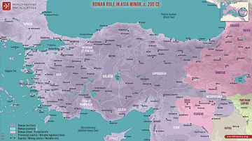
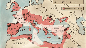
This map illustrates the Roman province of Asia around 200 CE. Established in 129 BCE following the bequest of the Attalid Kingdom of Pergamon to Rome, it encompassed western Anatolia (modern-day Turkey). It was a wealthy and vibrant region by 200 CE. Its major cities, including Ephesus, Pergamum, Smyrna, and Miletus, were hubs of trade, art, and intellectual activity, with an economy based on agriculture, textiles, and artisanal goods. Asia was deeply Romanized by this time, blending Roman infrastructure and law with its rich Greek heritage. Religious life was diverse, featuring temples to Greek and Roman gods, mystery cults, and a growing Christian presence. Governed by a proconsul, Asia was peaceful, loyal to Rome, and one of the empire’s most affluent and urbanized provinces.
About the Author
Cite This Work
APA Style
Netchev, S. (2025, January 09). Roman Province Asia c. 200 CE. World History Encyclopedia. Retrieved from https://www.worldhistory.org/image/19851/roman-province-asia-c-200-ce/
Chicago Style
Netchev, Simeon. "Roman Province Asia c. 200 CE." World History Encyclopedia. Last modified January 09, 2025. https://www.worldhistory.org/image/19851/roman-province-asia-c-200-ce/.
MLA Style
Netchev, Simeon. "Roman Province Asia c. 200 CE." World History Encyclopedia. World History Encyclopedia, 09 Jan 2025, https://www.worldhistory.org/image/19851/roman-province-asia-c-200-ce/. Web. 05 May 2025.


