
Illustration


A map of Erie Canal c. 1840. The canal, constructed between 1817 and 1825, stretches 363 miles (584 km) from the Hudson River at Albany, New York, to Lake Erie at Buffalo, New York.
License & Copyright
 Based on Wikipedia content that has been reviewed, edited, and republished.
Original image by Unknown Author. Uploaded by Scarlett Hart, published on 19 February 2025. The copyright holder has published this content under the following license: Public Domain. This item is in the public domain, and can be used, copied, and modified without any restrictions. Please note that content linked from this page may have different licensing terms.
Based on Wikipedia content that has been reviewed, edited, and republished.
Original image by Unknown Author. Uploaded by Scarlett Hart, published on 19 February 2025. The copyright holder has published this content under the following license: Public Domain. This item is in the public domain, and can be used, copied, and modified without any restrictions. Please note that content linked from this page may have different licensing terms.
Related Images
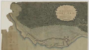
Siege and Defence of Fort Erie
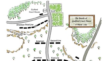
Battle of Guilford Court House, Battle Map
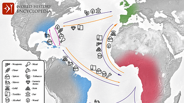
Transatlantic Triangular Trade Map
Battle of Brandywine Map
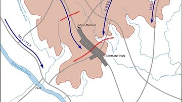
Battle of Germantown Map
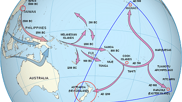
Polynesian Migration Map
Cite This Work
APA Style
Author, U. (2025, February 19). Map of Erie Canal. World History Encyclopedia. Retrieved from https://www.worldhistory.org/image/20055/map-of-erie-canal/
Chicago Style
Author, Unknown. "Map of Erie Canal." World History Encyclopedia. Last modified February 19, 2025. https://www.worldhistory.org/image/20055/map-of-erie-canal/.
MLA Style
Author, Unknown. "Map of Erie Canal." World History Encyclopedia. World History Encyclopedia, 19 Feb 2025, https://www.worldhistory.org/image/20055/map-of-erie-canal/. Web. 17 Apr 2025.