
Illustration


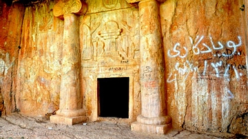
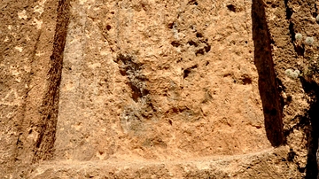
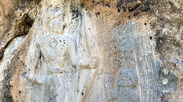
This rock-relief lies on one of the tops of Mt. Pira Magroon, Sulaimaniya, Iraq. In 2009 CE, a small mountain settlement was excavated on the top of Mt. Merquli (Kurdish: مير قولي), the peak just south of Mt. Pira Magroon, by a team from the Sulaymaniyah Board of Antiquities, directed by Mr. Zuhair Rajab. The settlement has been attributed to the Parthian period because of a nearby rock relief that overlooks the entrance to the mountain valley of the modern village Zewiya, which shows a man in Parthian royal dress facing towards the valley. This image shows the relief. There is no inscription and at present it must remain open whether this image shows one of the Arsacid kings or a local ruler. According to Mr. Hashim Hama Abdullah, the relief was discovered accidentally by a local villager in the year 1999 CE.
Information from Mark Altaweel, Anke Marsh, Simone Mühl, Olivier Nieuwenhuyse, Karen Radner, Kamal Rasheed and Saber Ahmed Saber (2012). New Investigations in the Environment, History, and Archaeology of the Iraqi Hilly Flanks: Shahrizor Survey Project 2009-2011. Iraq, 74, pp 1-35. doi:10.1017/S0021088900000231.
About the Author

Related Images
Kiz Kapan Cave, Iraqi Kurdistan
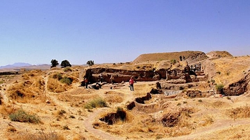
The Ancient Mound of Bakr Awa, Sulaimaniya, Kurdistan
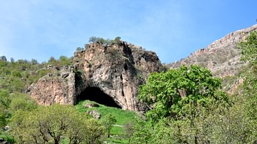
Shanidar Cave, Kurdistan, Iraq
Rock-Relief of Mountain Rabana
Rock relief of Mountain Hareer
Rock-Relief of Tar...dunni, Darband-i Belula
Cite This Work
APA Style
Amin, O. S. M. (2013, October 05). Merquli's Rock Relief, Iraqi Kurdistan. World History Encyclopedia. Retrieved from https://www.worldhistory.org/image/2044/merqulis-rock-relief-iraqi-kurdistan/
Chicago Style
Amin, Osama Shukir Muhammed. "Merquli's Rock Relief, Iraqi Kurdistan." World History Encyclopedia. Last modified October 05, 2013. https://www.worldhistory.org/image/2044/merqulis-rock-relief-iraqi-kurdistan/.
MLA Style
Amin, Osama Shukir Muhammed. "Merquli's Rock Relief, Iraqi Kurdistan." World History Encyclopedia. World History Encyclopedia, 05 Oct 2013, https://www.worldhistory.org/image/2044/merqulis-rock-relief-iraqi-kurdistan/. Web. 17 Apr 2025.