
Illustration


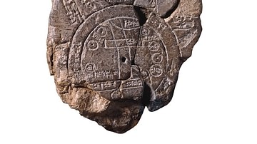
This tablet contains both a cuneiform inscription and a unique map of the Mesopotamian world. Babylon is shown in the center (the rectangle in the top half of the circle), and Assyria, Elam and other places are also named. The central area is ringed by a circular waterway labelled 'Salt-Sea'. The outer rim of the sea is surrounded by what were probably originally eight regions, each indicated by a triangle, labelled 'Region' or 'Island', and marked with the distance in between. The cuneiform text describes these regions, and it seems that strange and mythical beasts as well as great heroes lived there, although the text is far from complete. Babylonian, about 700-500 BCE, probably from Sippar, Mesopotamia, Iraq.
About the Author

Related Images
Babylonian Map of the World
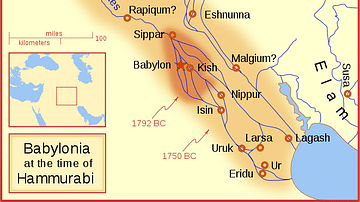
Babylon at the time of Hammurabi
Khalid ibn al-Walid's Invasion of Iraq
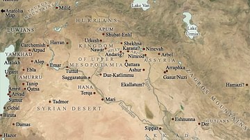
Map of Mesopotamia, 2000-1600 BCE
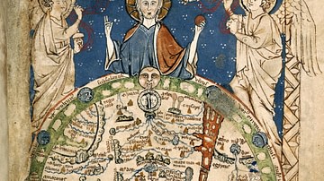
Psalter World Map
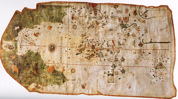
Map of the World by Juan de la Cosa
Cite This Work
APA Style
Amin, O. S. M. (2014, February 04). Map of the World from Sippar, Mesopotamia. World History Encyclopedia. Retrieved from https://www.worldhistory.org/image/2287/map-of-the-world-from-sippar-mesopotamia/
Chicago Style
Amin, Osama Shukir Muhammed. "Map of the World from Sippar, Mesopotamia." World History Encyclopedia. Last modified February 04, 2014. https://www.worldhistory.org/image/2287/map-of-the-world-from-sippar-mesopotamia/.
MLA Style
Amin, Osama Shukir Muhammed. "Map of the World from Sippar, Mesopotamia." World History Encyclopedia. World History Encyclopedia, 04 Feb 2014, https://www.worldhistory.org/image/2287/map-of-the-world-from-sippar-mesopotamia/. Web. 06 May 2025.