
Illustration


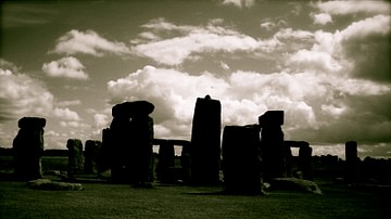
The site of Stonehenge as of 2004. The plan omits the trilithon lintels for clarity. Holes that no longer, or never, contained stones are shown as open circles and stones visible today are shown coloured, grey for sarsen and blue for the imported stone, mainly bluestone.
Key to plan:
- The Altar Stone, a six ton monolith of green micaceous sandstone from Wales
- barrow without a burial
- "barrows" (without burials)
- the fallen Slaughter Stone, 4.9 metres long
- the Heel Stone
- two of originally four Station Stones
- ditch
- inner bank
- outer bank
- The Avenue, a parallel pair of ditches and banks leading 3 km to the River Avon
- ring of 30 pits called the Y Holes
- ring of 29 pits called the Z Holes
- circle of 56 pits, known as the Aubrey holes
- smaller southern entrance
Sources:
- Cleal, Walker, & Montague, Stonehenge in its Landscape (London, English Heritage 1995)
- Pitts, M, Hengeworld (London, Arrow 2001)
License & Copyright
 Based on Wikipedia content that has been reviewed, edited, and republished.
Original image by Adamsan. Uploaded by Jan van der Crabben, published on 26 April 2012. The copyright holder has published this content under the following license: Creative Commons Attribution-ShareAlike. This license lets others remix, tweak, and build upon a work even for commercial reasons, as long as they credit the author and license their new creations under the identical terms. When republishing on the web a hyperlink back to the original content source URL must be included. Please note that content linked from this page may have different licensing terms.
Based on Wikipedia content that has been reviewed, edited, and republished.
Original image by Adamsan. Uploaded by Jan van der Crabben, published on 26 April 2012. The copyright holder has published this content under the following license: Creative Commons Attribution-ShareAlike. This license lets others remix, tweak, and build upon a work even for commercial reasons, as long as they credit the author and license their new creations under the identical terms. When republishing on the web a hyperlink back to the original content source URL must be included. Please note that content linked from this page may have different licensing terms.
Related Images
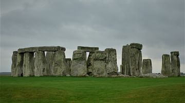
Stonehenge, Salisbury Plain
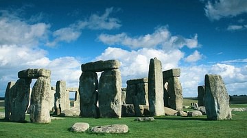
Stonehenge
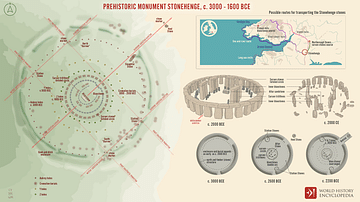
Prehistoric Monument Stonehenge, c. 3000 - 1600 BCE
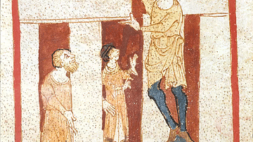
Merlin Constructs Stonehenge, Roman de Brut
Stonehenge, Amesbury, UK
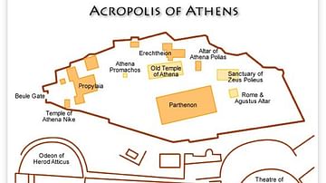
Acropolis Plan, Athens
Cite This Work
APA Style
Adamsan. (2012, April 26). Plan of Stonehenge. World History Encyclopedia. Retrieved from https://www.worldhistory.org/image/308/plan-of-stonehenge/
Chicago Style
Adamsan. "Plan of Stonehenge." World History Encyclopedia. Last modified April 26, 2012. https://www.worldhistory.org/image/308/plan-of-stonehenge/.
MLA Style
Adamsan. "Plan of Stonehenge." World History Encyclopedia. World History Encyclopedia, 26 Apr 2012. Web. 15 Apr 2025.