
Illustration


This map illustrates the Indus Valley Civilization (Harappan Civilization, Indus-Sarasvati Civilization). Thriving from around 3300 to 1300 BCE, it was one of the earliest known urban societies situated in what is now Pakistan and northwest India. Renowned for its highly organized cities like Harappa and Mohenjo-Daro, it featured grid-based urban planning, advanced drainage systems, and uniform building materials. This civilization was deeply engaged in trade with distant regions such as Mesopotamia and Egypt. The consistent layout of its numerous cities indicates a centralized authority that coordinated urban development. Despite the absence of monumental religious or royal architecture, the culture displayed remarkable technological and cultural sophistication. The civilization's eventual decline around 1300 BCE is attributed to environmental factors, such as climate change and disruptions in trade.
About the Author

Related Images
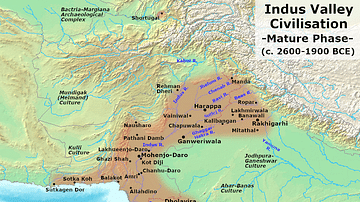
Indus Valley Civilization - Mature Harappan Phase

India in the Vedic Age, 1500 BCE-500 BCE
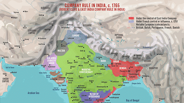
Robert Clive & The East India Company Rule in India, c. 1765
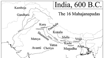
Map of India, 600 BCE
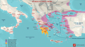
The Greek City-states c. 500 BCE
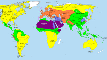
Map of the World in 1000 BCE
Cite This Work
APA Style
Netchev, S. (2012, April 26). Map of the Indus Valley Civilization, c.3300 - 1300 BCE. World History Encyclopedia. Retrieved from https://www.worldhistory.org/image/322/map-of-the-indus-valley-civilization-c3300---1300/
Chicago Style
Netchev, Simeon. "Map of the Indus Valley Civilization, c.3300 - 1300 BCE." World History Encyclopedia. Last modified April 26, 2012. https://www.worldhistory.org/image/322/map-of-the-indus-valley-civilization-c3300---1300/.
MLA Style
Netchev, Simeon. "Map of the Indus Valley Civilization, c.3300 - 1300 BCE." World History Encyclopedia. World History Encyclopedia, 26 Apr 2012. Web. 14 Apr 2025.