
Illustration


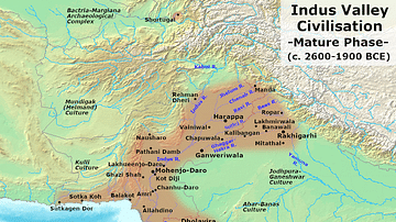
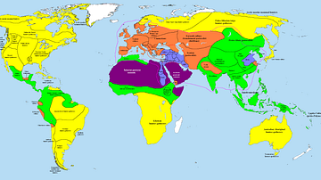
This map illustrates the extent and key urban centers of the Indus Valley Civilization (circa 3300–1300 BCE), one of the world’s earliest complex societies. Spanning parts of modern-day Pakistan and northwest India, this civilization was notable for its large, well-planned cities, sophisticated infrastructure, and extensive trade networks.
Often referred to as the Harappan or Indus-Sarasvati Civilization, it featured cities such as Harappa and Mohenjo-Daro that showcased grid-based layouts, advanced drainage systems, and standardized construction techniques. Its people traded goods with regions as far as Mesopotamia and Egypt, yet left behind no grand temples or palaces, suggesting a society that emphasized order, commerce, and civic planning over monumental display. The decline of civilization after 1300 BCE is widely linked to environmental change, shifts in river patterns, and the breakdown of long-distance trade networks.
About the Author

Related Images
Indus Valley Civilization - Mature Harappan Phase

India in the Vedic Age, 1500 BCE-500 BCE
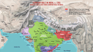
Robert Clive & The East India Company Rule in India, c. 1765
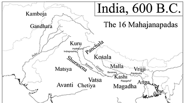
Map of India, 600 BCE
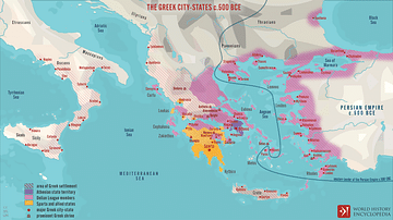
The Greek City-states c. 500 BCE
Map of the World in 1000 BCE
Cite This Work
APA Style
Netchev, S. (2012, April 26). Map of the Indus Valley Civilization, c.3300-1300 BCE. World History Encyclopedia. Retrieved from https://www.worldhistory.org/image/322/map-of-the-indus-valley-civilization-c3300-1300-bc/
Chicago Style
Netchev, Simeon. "Map of the Indus Valley Civilization, c.3300-1300 BCE." World History Encyclopedia. Last modified April 26, 2012. https://www.worldhistory.org/image/322/map-of-the-indus-valley-civilization-c3300-1300-bc/.
MLA Style
Netchev, Simeon. "Map of the Indus Valley Civilization, c.3300-1300 BCE." World History Encyclopedia. World History Encyclopedia, 26 Apr 2012, https://www.worldhistory.org/image/322/map-of-the-indus-valley-civilization-c3300-1300-bc/. Web. 26 Apr 2025.