
Illustration


Map of the Roman province of Dacia, part of modern-day Romania and Serbia, between the era of Trajan (106 CE) and the evacuation of the province in 271 CE. Roman settlements and legion garrisons with Latin names included.
Related Images
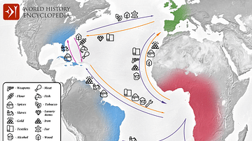
Transatlantic Triangular Trade Map
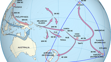
Polynesian Migration Map
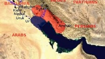
Elam Map
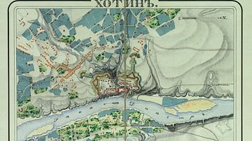
Map of the Khotyn Fortress
Battle of Brandywine Map
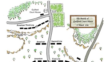
Battle of Guilford Court House, Battle Map
Cite This Work
APA Style
nacu, A. (2012, April 26). Map of Roman Dacia. World History Encyclopedia. Retrieved from https://www.worldhistory.org/image/331/map-of-roman-dacia/
Chicago Style
nacu, Andrei. "Map of Roman Dacia." World History Encyclopedia. Last modified April 26, 2012. https://www.worldhistory.org/image/331/map-of-roman-dacia/.
MLA Style
nacu, Andrei. "Map of Roman Dacia." World History Encyclopedia. World History Encyclopedia, 26 Apr 2012. Web. 28 Mar 2025.