Illustration
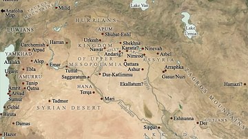
A satellite photograph of the site of Tell Hariri, Syria. Tell Hariri is the site of the ancient city of Mari, which, at various times from c. 3000 BCE - c. 1760 BCE, controlled large portions of Northern Mesopotamia. The photograph has been labelled with the locations of the major monuments at the site that have been excavated. It is unknown when this image was taken however the state of the site suggests prior to 2012 CE as the site has suffered heavy looting since the beginning of the Syrian Civil War.
Cite This Work
APA Style
syria, A. (2016, January 18). Labelled map of Mari, modern-day Tell Hariri, Syria. World History Encyclopedia. Retrieved from https://www.worldhistory.org/image/4416/labelled-map-of-mari-modern-day-tell-hariri-syria/
Chicago Style
syria, Attar-Aram. "Labelled map of Mari, modern-day Tell Hariri, Syria." World History Encyclopedia. Last modified January 18, 2016. https://www.worldhistory.org/image/4416/labelled-map-of-mari-modern-day-tell-hariri-syria/.
MLA Style
syria, Attar-Aram. "Labelled map of Mari, modern-day Tell Hariri, Syria." World History Encyclopedia. World History Encyclopedia, 18 Jan 2016, https://www.worldhistory.org/image/4416/labelled-map-of-mari-modern-day-tell-hariri-syria/. Web. 27 Apr 2025.


