
Illustration


A map showing the various campagins of Celtic tribes between the 6th and 3rd centuries BCE.
License & Copyright
 Based on Wikipedia content that has been reviewed, edited, and republished.
Original image by Alexikoua. Uploaded by Mark Cartwright, published on 04 April 2016. The copyright holder has published this content under the following license: Creative Commons Attribution-ShareAlike. This license lets others remix, tweak, and build upon a work even for commercial reasons, as long as they credit the author and license their new creations under the identical terms. When republishing on the web a hyperlink back to the original content source URL must be included. Please note that content linked from this page may have different licensing terms.
Based on Wikipedia content that has been reviewed, edited, and republished.
Original image by Alexikoua. Uploaded by Mark Cartwright, published on 04 April 2016. The copyright holder has published this content under the following license: Creative Commons Attribution-ShareAlike. This license lets others remix, tweak, and build upon a work even for commercial reasons, as long as they credit the author and license their new creations under the identical terms. When republishing on the web a hyperlink back to the original content source URL must be included. Please note that content linked from this page may have different licensing terms.
Related Images
Olmec Jade Celt
Map of 2nd Century Roman Expansion
United States Expansion after the Treaty of Paris in 1783
Territorial Expansion of the Roman Republic (c. 260 - 30 BCE)
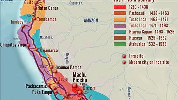
Inca Empire - Expansion and Roads

Map of the Expansion of Macedon
Cite This Work
APA Style
Alexikoua. (2016, April 04). Map of Celtic Expansion - 6th-3rd century BCE. World History Encyclopedia. Retrieved from https://www.worldhistory.org/image/4862/map-of-celtic-expansion---6th-3rd-century-bce/
Chicago Style
Alexikoua. "Map of Celtic Expansion - 6th-3rd century BCE." World History Encyclopedia. Last modified April 04, 2016. https://www.worldhistory.org/image/4862/map-of-celtic-expansion---6th-3rd-century-bce/.
MLA Style
Alexikoua. "Map of Celtic Expansion - 6th-3rd century BCE." World History Encyclopedia. World History Encyclopedia, 04 Apr 2016. Web. 05 Jul 2024.