
Search
Remove Ads
Advertisement
Search Results
Image
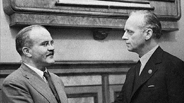
Molotov & Ribbentrop, 1939
A 1939 photograph of Vyacheslav Molotov (1890-1986), the People’s Commissar of Foreign Affairs for the USSR, and Joachim von Ribbentrop (1893-1946), German foreign minister, during negotiations of the Nazi-Soviet Pact.
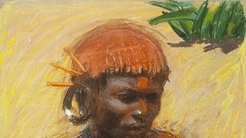
Image
Kikuyu Kenosua by Gallen-Kallela
A c. 1909 pastel portrait by Akseli Gallen-Kallela (1865-1931) of a Kikuyu man, Kenosua. The Kikuyu people began to occupy central Kenya from the 17th century and remain its largest ethnic group. Kenousa was an assistant and friend of the...
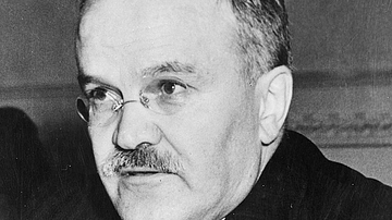
Image
Vyacheslav Molotov
A 1945 photograph of Vyacheslav Molotov (1890-1986), the People’s Commissar of Foreign Affairs for the USSR and negotiator of the Nazi-Soviet Pact of 1939. (Netherlands National Archives)
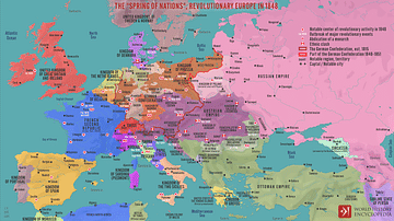
Image
The "Spring of Nations", Revolutionary Europe in 1848
A map illustrating the series of republican revolts and political upheavals against European monarchies in 1848, also known as the People's Spring or the Spring of Nations. The widespread violent unrest started in Sicily and, within a short...
Image
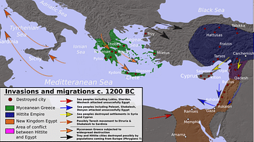
Bronze Age Mediterranean Invasions & Migrations
A map of the Late Bronze Age Mediterranean indicating the various invasions and migrations of the period.

Image
Traditional Kikuyu Hut
A traditional hut of the Kikuyu people at Bomas, Kenya.
Image
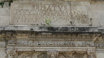
Inscription, Arch of Titus
The inscription from the Triumphal Arch of Titus, erected in the Roman Forum in c. 81 CE by Domitian to commemorate his brother Titus' campaigns in the Jewish War (70-71 CE). It reads: The Senate and People of Rome, to Divus Titus, son of...
Image
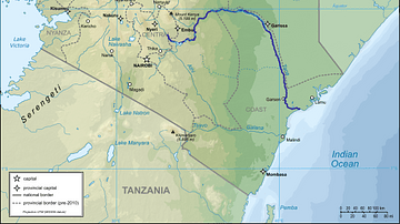
Map of Kenya with Tana River Indicated
A map of Kenya showing the Tana River highlighted in blue.
(By: Internal Map of the World (UTA) - derivative work: Svenskan)

Image
Banpo Village Tomb
Banpo Village is a Neolithic site in the Yellow River Valley, east of Xi'an, Shaanxi Province, in the People's Republic of China. There have been 250 discovered and excavated with male and female buried in separate graveyards. The site was...
Image
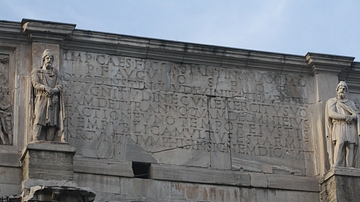
Inscription, Arch of Constantine I
The inscription which appears on both sides of the Arch of Constantine I in Rome. Dedicated in 315 CE, the triumphal arch celebrates the emperor's victory over the Roman tyrant Maxentius in 312 CE. The inscription reads: IMP CAES FL CONSTANTINO...