
Search
Remove Ads
Advertisement
Search Results
Image
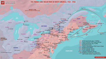
The French and Indian War in North America, 1754 - 1763
A map illustrating the course and major events of the French and Indian War (1754 - 1763), a crucial North American conflict within the broader Seven Years' War between Great Britain and France. It started in 1754, pitching France, French...
Image
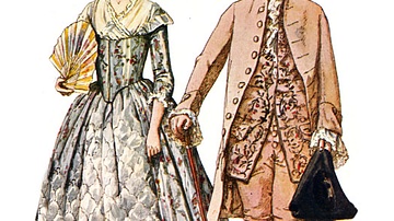
Formal Attire in Colonial America
A drawing of a couple in traditional Colonial American formal attire. The woman wears a richly decorated brocade dress with floral designs, while the man is dressed in a suit of uncut velvet and holds a tricorne hat. From Historic Dress in...
Image
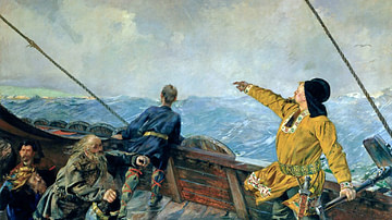
Leif Erikson Sighting America
Painting by Christian Krogh (1852-1925 CE) depicting the Norse Viking Leif Erikson discovering America. Leif is credited by the 13th-century CE Icelandic Vinland Sagas with discovering and/or being the leader of the first European crew to...
Image
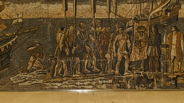
Columbus' Arrival in America
Mosaic at the Metro Station Avenida de America, Madrid, representing the discovery of the New World by Christopher Columbus (l. 1451-1506 CE).
Image
Norse America: The Story of a Founding Myth by Gordon Campbell
Cover of Norse America: The Story of a Founding Myth by Gordon Campbell. Published by Oxford University Press.

Video
Norse America: The Story of a Founding Myth
In our interview with Gordon Campbell, we chat all about his new book Norse America: The Story of a Founding Myth. The book tells two stories. One story is that of the Norse proceeding in the 10th and 11th century from mainland Scandinavia...
Image
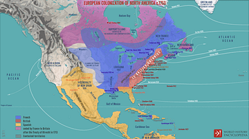
European Colonization of North America c.1750
A map illustrating the process of systematic European colonization of North America during the Age of Exploration - from the 1490s until the start of the French and Indian War of 1750s. It also depicts the shift of balance of power in the...

Image
Spanish Conquest & Exploration in South America in the 16th Century
A map illustrating Spain’s drive to expand its empire in South America following the occupation of the larger Caribbean islands by 1512. The promise of gold drove the Spaniards far and wide across the continent, from the Isthmus of Panama...
Image
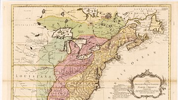
English & French Colonies in North America, 1758 CE
Map of English and French colonies in North America c. 1758 CE. English-controlled colonies are shown in yellow, French colonies in green, and disputed territories in red. Collection of the Library of Congress, Washington, D.C.
Image
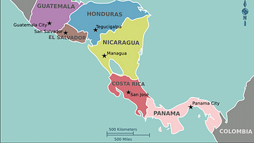
Modern Map of Central America
A map of modern Central America.