
Search
Remove Ads
Advertisement
Search Results
Image
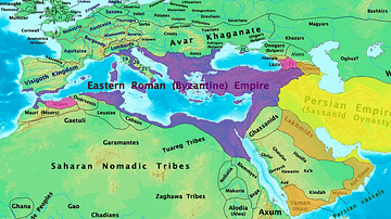
Byzantine & Persian Empires in the 7th Century
A map showing the extent of the Byzantine Empire and the Sasanian Empire in the 7th century.
Image
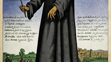
17th-century Depiction of Plague Doctor
A depiction of "Doctor Schnabel" ("Schnabel" is literally German for "Beak"), a plague doctor in Rome. The illustration appeared in a 17th -century German satirical manuscript. The engraving was first published by Paul Fürst (1608–1666...
Image
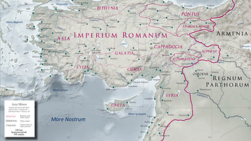
Asia Minor in the Early 1st Century CE
Map of Asia Minor in the early 1st century CE with the Kingdom of Commagene as a Roman client state.
Image
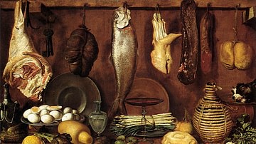
16th Century CE Kitchen Still-life
A still-life of a 16th century CE kitchen by Jacopo Chimenti. (Private Collection)
Image
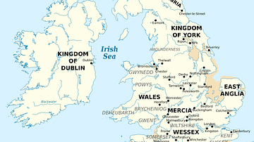
British Isles at the Beginning of the 10th Century
British Isles in 10th century represented with the coastline at the time.
Image
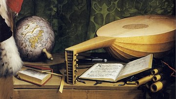
16th century CE Desk with Lute, Globe and Books
A detail of a mid-16th century CE painting by Hans Holbein the Younger showing a desk with a lute, globe and books. From 'The Ambassadors', c. 1533 CE. (National Gallery, London)
Image
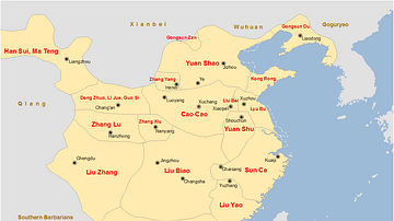
China Warlords, 2nd-3rd century CE.
A map showing the territories of the main Chinese warlords at the fall of the Han dynasty in the early 3rd century CE.
Image
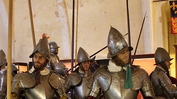
European 16th Century Armour
Typical weapons and armour used in European warfare in the 16th century and by conquistadors in the New World. (Grand Master's Palace Armoury, Valletta, Malta)
Image
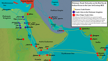
Ptolemaic Trade Networks in the Late 1st Century BCE
This map illustrates the trading networks which connected the Ptolemaic Kingdom to South Asia and East Africa by the second half of the 1st century BCE. During this time period, Ptolemaic Egypt was a major player in the spice trade which...
Image
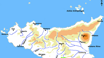
Map of Greek Sicily, 5th Century BCE
A map indicating the principal towns in Sicily during the 5th century BCE.