
Search
Did you mean: Noah?
Remove Ads
Advertisement
Summary 
Loading AI-generated summary based on World History Encyclopedia articles ...
Search Results

Definition
Silk Road
The Silk Road was a network of ancient trade routes, formally established during the Han Dynasty of China in 130 BCE, which linked the regions of the ancient world in commerce between 130 BCE-1453 CE. The Silk Road was not a single route...

Article
The Inca Road System
The Inca road system formed a network known as the royal highway or qhapaq ñan, which became an invaluable part of the Inca empire. Roads facilitated the movement of armies, people, and goods across plains, deserts, and mountains. They connected...
Article
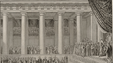
Louis XVI, the Girondins, & the Road to Revolutionary War (1791-92)
On 20 April 1792, King Louis XVI of France (r. 1774-1792) stood before the Legislative Assembly and, with a faltering voice, read a declaration of war against Austria, to the ecstatic delight of the gathered deputies. This declaration sealed...
Image
Inca Road System
A map of the Inca road system which included some 40,000 km of routes.

Image
Roman Road Surface
A section of a Roman road with a typical polygonal stone surface. The stones also show the ruts made by Roman wheeled vehicles. This section is beneath the Arco dei Gavi, a 1st century CE arch in Verona, Italy.
Image
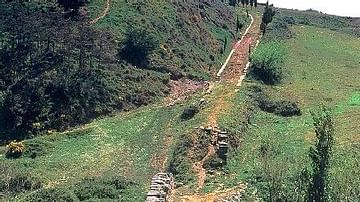
Roman Road, Spain
A section of surviving Roman road near Cirauqui in northern Spain. The curb stones can be clearly seen, a common feature of Roman roads.
Image
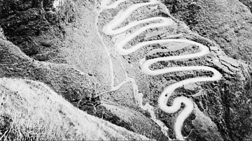
The Ledo Road
An aerial view of the Ledo Road in Burma (Myanmar), a land connection between India and China used by Allied troops during the Second World War (1939-45) following the closure of the more famous Burma Road. The road was in use from February...
Image
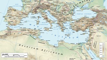
Roman Road Network
A map showing the principal routes of the Roman road network in 125 CE.

Image
Inca Road & Bridge
An Inca mountain road with bridge, approaching Machu Picchu.
Image
The Silk Road at Its Height in the Late 8th Century
This map illustrates the Silk Road in the late 8th century, a vast network connecting Tang China, Central Asia, the Islamic world, and Europe. More than just a silk route, it enabled the exchange of luxury goods, technologies, and religions...