
Search
Remove Ads
Advertisement
Summary 
Loading AI-generated summary based on World History Encyclopedia articles ...
Search Results
Definition
Tikal
Tikal, located in the north of the Petén region of Guatemala, was a major Maya city which flourished between 300 and 850 CE. The city, known to the Maya themselves as Mutul, is one of the grandest in Mesoamerica. Amongst the first Maya cities...
Definition
K'inich Yax K'uk' Mo
Yax K'uk' Mo' (pronounced `Yash Kook Mo') was the founder and first king of the dynasty that ruled the Maya city of Copan (in modern day Honduras) for 350 years. Known formally by his royal name, K'inich Yax K'uk' Mo', he reigned for eleven...
Image
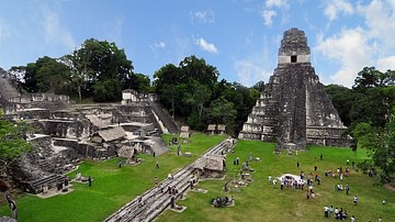
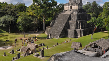
Tikal Main Plaza
The central plaza of Tikal, Guatemala. The Maya city flourished between 300 and 850 CE. On the left is the North Acropolis whilst on the right is Temple I, the tomb of Jasaw Chan K'awiil (r. 682-734 CE).
Image
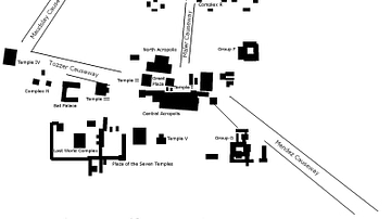
Tikal Map
A map of the principal monuments of Tikal, Guatemala. The Maya city flourished between 300 and 850 CE.

Image
Tikal, Guatemala
The ruins of the Maya city of Tikal in what is now northern Guatemala.

Video
Tikal National Park (UNESCO/NHK)
In the heart of the jungle, surrounded by lush vegetation, lies one of the major sites of Mayan civilization, inhabited from the 6th century B.C. to the 10th century A.D: Tikal, Guatemala. The ceremonial centre contains superb temples and...
Image
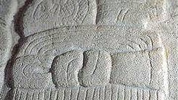
Maya Tikal Glyph
The Maya glyph for Tikal. From a stela in the Archaeological Museum of Tikal.
Image
Temple II, Tikal
Temple II, Tikal, Guatemala. The temple was used as a tomb, probably for the queen of Maya ruler Jasaw Chan K'awiil (r. 682-734 CE), although, no remains have been discovered. The temple is 42 metres high and faces the larger temple-pyramid...

Video
Tikal 3D Laser Scan Fly-through
3D fly through created from laser scan and photography at Maya city of Tikal (300-850 CE) in Guatemala by CyArk.
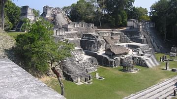
Image
North Acropolis, Tikal
The North Acropolis of Tikal, Guatemala. The Maya city flourished between 300 and 850 CE but the acropolis was first built c. 250 BCE with many additions being made to it over the centuries. A total of 12 temples were built and used to bury...