
Search Images
Browse Content (p. 1036)
Image
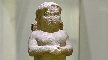
Statue of a Woman from Ashur
This smaller than life limestone statue depicts an Assyrian woman. She clasps her hands in a prayer gesture. The name of the woman is unidentified. From Ashur (Assur), in modern-day Saladin Governorate, Iraq. Neo-Assyrian period, 911-612...
Image
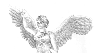
Artist’s impression of the Nike of Samothrace
Artist’s impression of the Nike of Samothrace with head, arms, feet, and right wing restored.

Image
Relief of a Neo-Assyrian Queen
Limestone stele fragment depicting a woman looking to the left and wearing a headdress of the royal women. From Kli'eh, near Haditha Dam, Al-Anbar Governorate, Iraq. Neo-Assyrian Empire, 911-612 BCE.
The Iraq Museum, Baghdad.
Image
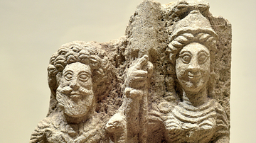
Goddess Al-Lat and an Elderly God from Hatra
This limestone slab carved in relief shows two deities. On the right, the goddess Al-Lat is depicted, she wears a military dress and helmet and holds a spear in her right hand and a shield in her left arm. Her appearance is similar to Athena...
Image
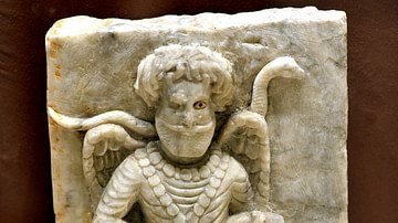
God and Goat from Hatra
Marble slab carved in raised relief, originally set into a base of an object with Aramaic inscription. It shows a winged and bearded male deity holding a dagger in his right hand and is about to slaughter a goat; he holds the right horn of...

Image
Temple Ritual Scene from Hatra
This limestone slab was carved in prominent sunken relief and depicts a temple ritual scene. A male figure wearing the head cap of Hatrene kings (very probably Sanatruq I who reigned c. 140 - 180 CE), holds a small bowl in his left hand while...
Image
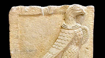
Relief of an Eagle from Hatra
The eagle was the symbol of the Hatrene army and reflects victory. There are Aramaic inscriptions below the eagle and behind his wings about certain laws in the city of Hatra. From Hatra, Ninawa Governorate, Iraq. Parthian period, 1st to...
Image
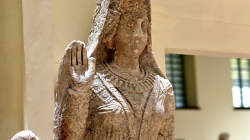
Statue of Abu Bint Jablo, Hatra
The Aramaic inscription on the base of the statute states that it was commissioned by Abu Bint Jablo's husband in her memory and that she was assassinated for an unknown reason under vague circumstances at the age of 18. The inscription also...
Image
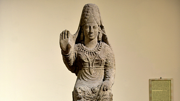
Statue of Princess Simi from Hatra
This is the upper part of the statue of Princess "Simi". Simi was the daughter of princess Doshafri, and granddaughter of king Sanatruq I (reigned c. 140 - 180 CE) through her mother. The overall depiction of the attire and pieces of jewelry...
Image
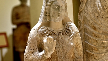
Princess Doshafri from Hatra
This is the upper part of the statue of princess "Doshafri", daughter of king Sanatruq I of Hatra (reigned c. 140 - 180 CE). Although the statue is somewhat weathered, it is an excellent example conveying the appearance of a Hatrene princess...