
Search Images
Browse Content (p. 1266)

Image
Ruined Interior of Arates Monastery in Central Armenia
The Arates Monastery in Armenia is built on top of a hill and overlooks the Arates tributary of the Yeghegis River. The monastery's name came from the combination of “ari” ("come" in Armenian) and...
Image
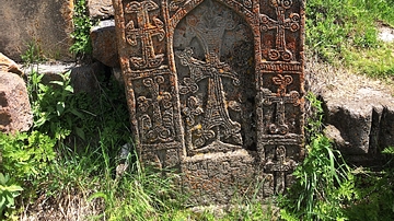
Khachkar at Arates Monastery in Armenia
Most of the ruins at Arates Monastery in Armenia date from the 10-13th centuries CE, and the khachkars and tombstones date from between the 10-17th centuries CE.
Image
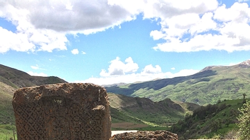
Khachkars at Arates Monastery in Armenia
Most of the ruins at Arates Monastery in Armenia date from the 10-13th centuries CE, and the khachkars and tombstones date from between the 10-17th centuries CE.

Image
Interior of Arates Monastery in Central Armenia
The Arates Monastery in Armenia is built on top of a hill and overlooks the Arates tributary of the Yeghegis River. The monastery's name came from the combination of “ari” ("come" in Armenian) and “tes”...

Image
Arates Monastery Ruins in Armenia
Arates Monastery in Armenia is built on top of a hill and overlooks the Arates tributary of the Yeghegis River. The monastery's name came from the combination of “ari” ("come" in Armenian) and “tes” ("see" in Armenian...

Image
Memorial Stone at Arates Monastery in Armenia
Arates Monastery in Armenia is built on top of a hill and overlooks the Arates tributary of the Yeghegis River. The monastery's name came from the combination of “ari” ("come" in Armenian) and “tes” ("see"...

Image
Architectural Ruins from Arates Monastery in Armenia
Arates Monastery in Armenia is built on top of a hill and overlooks the Arates tributary of the Yeghegis River. The monastery's name came from the combination of “ari” ("come" in Armenian) and “tes”...

Image
Stone Ruins from Arates Monastery in Armenia
Arates Monastery in Armenia is built on top of a hill and overlooks the Arates tributary of the Yeghegis River. The monastery's name came from the combination of “ari” ("come" in Armenian) and “tes” ("see"...

Image
Arates Monastery in Central Armenia
Arates Monastery in Armenia is built on top of a hill and overlooks the Arates tributary of the Yeghegis River. The monastery's name came from the combination of “ari” ("come" in Armenian) and “tes” ("see" in Armenian...

Image
Arates Monastery in Armenia
Arates Monastery in Armenia is built on top of a hill and overlooks the Arates tributary of the Yeghegis River. The monastery's name came from the combination of “ari” ("come" in Armenian) and “tes” ("see" in Armenian...
