
Search Images
Browse Content (p. 149)
Image
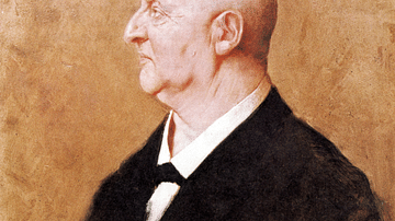
Anton Bruckner by von Kaulbach
An 1885 oil-on-carton portrait by Hermann von Kaulbach of the Austrian composer Anton Bruckner (1824-96). (Oberösterreichische Landesmuseen)

Image
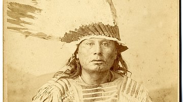
War Chief Gall of the Hunkpapa Lakota Sioux
Native American Hunkpapa Lakota Sioux War Chief Gall taken by D. F. Barry and hand signed and inscribed by Barry to the famous Indian Fighter and US Army General Charles King, 1880s.
Image
Sioux War Chief Gall
A cabinet card portrait of Hunkpapa Lakota Sioux war chief Gall (c. 1840-1894) in war bonnet, c. 1880s.

Image
Chief Gall of the Lakota Sioux in 1881
Lakota Sioux War Chief Gall, photographed by David Francis Barry at Fort Buford, North Dakota, 1881.
U.S. National Archives and Records Administration.
Image
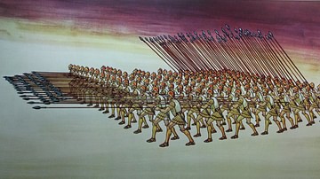
Macedonian Phalanx
An illustration of the Macedonian phalanx.
Hellenic War Museum, Athens, Greece.
Photo taken in 2016.
Image
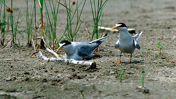
Nesting Least Terns on Missouri River
A nesting least tern pair in the sandbar habitat on the Missouri River below Gavins Point Dam. Yankton, South Dakota, USA. Photograph and caption by Robert Etzel.
U.S. Army Corps of Engineers Digital Library.
Image
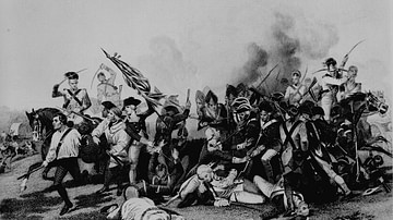
Battle of Camden
A depiction of the Battle of Camden (16 August 1780), showing the moment when General Johann de Kalb is mortally wounded. Kalb is depicted lying on the ground in the center, getting bayoneted. Engraving from a painting by Alonzo Chappel...
Image
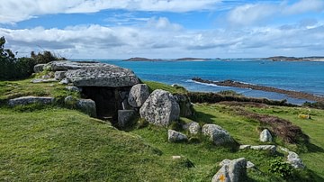
Bant's Carn Entrance Grave
Bant's Carn is a Scillionian entrance grave in very well-preserved condition. It is located on the island of St. Mary's in the Isles of Scilly, UK. It was excavated in 1900 by the archaeologist George Bonsor where he found piles of cremated...

Image
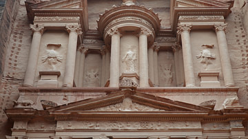
Lower Level of the Treasury of Petra
The lower level of the Treasury (Al-Khazneh) of Petra (Jordan) consists of a four-columned, pedimented portico flanked by shallow recesses and two sides columns. The reliefs on the lower level are 5 meters high and depict the Dioscuri, the...
Image
Upper Level of the Treasury of Petra
The upper level of the Treasury (Al-Khazneh) of Petra (Jordan) has a circular temple structure (tholos) with a conical roof between recessed Corinthian colonnades and two projecting pavilions capped by half pediments.