
Search Images
Browse Content (p. 1507)
Image
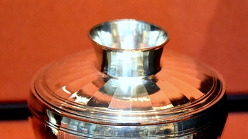
Silver Lidded Bowl from the Carthage Treasure
This lidded bowl is the the only surviving complete example of its kind. The handle on the top doubled as the foot ring, enabling the lid to be turned upside-down and used as a dish for serving food. The outer surface is ornamented with broad...
Image
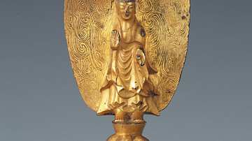
Gilt-bronze Buddha, Goguryeo Kingdom
A gilt-bronze standing Buddha. Cast in Pyongyang, Goguryeo Kingdom, 6th century CE. Height c. 15 cm. (National Museum of Korea, Seoul, South Korea)

Image
Goguryeo Roof Tile
The end face of a Goguryeo roof tile, 5th-6th century CE. (National Museum of Korea, Seoul, South Korea)

Image
Tortoise & Snake Mural, Goguryeo Tomb
A wall-painting depicting a tortoise and snake (symbolising North) from the Great Tomb at Kangso near Pyongyang. Goguryeo kingdom, early 7th century CE.
Image
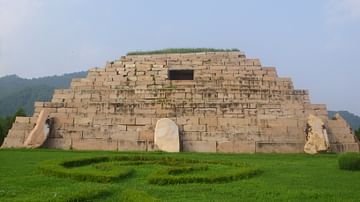
Tomb of Gwanggaeto the Great
The tomb of Goguryeo king Gwanggaeto the Great (r. 391–412 CE), aka the Tomb of the General, Korea. It measures 75 metres along the sides. The dolmen were originally placed at each of the four corners.

Image
Libyan Figure Statue
An Egyptian statuette representing a Libyan or Berber. Reign of Rameses II (19th Dynasty), 1279–1213 BCE. (Louvre Museum, Paris)
Image
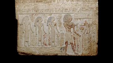
Intef
Limestone stela of Intef, son of Ka. Intef is shown standing, receiving an offering from a small male figure who stands in front of him. 11th Dynasty, First Intermediate Period of Egypt.

Image
Intef II
Funerary stele of Intef II (11th Dynasty of Egypt), Metropolitan Museum of Art

Image
Ipuwer Papyrus
19th Dynasty copy of the Ipuwer Papyrus (known as The Lamentations of Ipuwer or The Admonitions of Ipuwer) in which a Middle Kingdom scribe laments the depths to which the country of Egypt has fallen. Rijksmuseum van Oudheden, Leiden, The...
Image
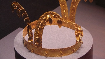
Gold Gaya Crown
A gold crown from the Gaya confederacy, 42-532 CE, southern Korea. (National Museum of Korea, Seoul, South Korea)