
Search Images
Browse Content (p. 1522)
Image
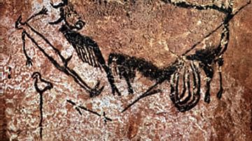
Wounded Bull, Man & Bird, Lascaux Cave
Cave art in the Lascaux Cave in the Dordogne region, southwestern France. Dated to the Upper Palaeolithic period. It depicts a wounded aurochs bull, a man and a bird.

Image
Painting of a Horse, Lascaux Cave
Horse depicted in Lascaux Cave in the Dordogne, southwestern France, dated to the Upper Paleolithic period.
Image
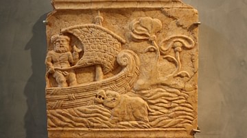
Ship Relief, Saguntum
A marble relief plaque depicting a ship in African waters. 2nd - 3rd century CE. (Archaeological Museum, Sagunto, Spain)
Image
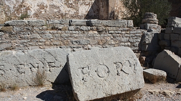
Inscription Stones, Forum of Saguntum
Blocks carrying a Latin inscription of the imperial forum of Roman Saguntum (Sagunto), Spain. 1st century CE.
Image
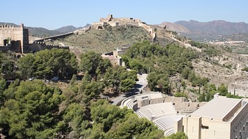
Acropolis & Theatre of Saguntum
The fortified acropolis and theatre of the Iberian-Roman town of Saguntum (Sagunto), Spain. Fortified since the 5th century BCE, the walls today date to the 11th century CE with later additions. The restored theatre dates to the 1st century...

Image
Roman Stone Anchor
A Roman stone anchor from the coast of Saguntum (Sagunto), Spain. 1st century CE. (Archaeological Museum, Sagunto)
Image
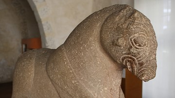
Iberian Bull Sculpture
Iberian-Celtic bull sculpture from Saguntum (Sagunto), Spain. 4th century BCE. (Archaeological Museum, Sagunto)
Image
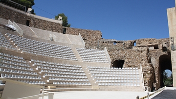
Roman Theatre, Saguntum
The restored 1st century CE Roman theatre of Saguntum (Sagunto), Spain.

Image
Om
The Om (Aum) is an important spiritual symbol in Indian religions. It is often used as a reference to Brahman (the Universal Intellect, the Ultimate Reality).
Image
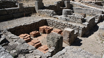
Wine Smokehouses, Glanum
Two wine smokehouses from Hellenistic Glanum in southern France. The bricks were used to create a raised floor through which fires could send smoke to better preserve wine. 2nd-1st century BCE.