
Search Images
Browse Content (p. 1528)
Image
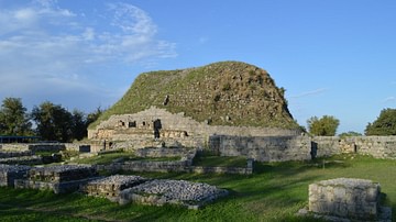
Dharmarajika Stupa (Taxila)
Dharmarajika stupa is land mark of Gandhara Art/Civilization. This stupa is locally called “Cheer Top” in Taxila (Punjab-Pakistan). This stupa is attributed to Asoka the Great and was erected in the 3rd Century BCE. It is the largest stupa...
Image
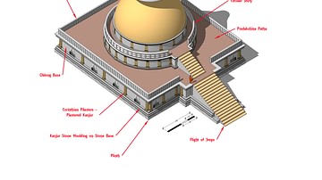
Stupa - Labelled Isometric View
An isometric image of Badalpur stupa showing the various elements which make up a stupa. Dated to 2nd - 5th Cent CE
Image
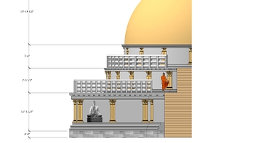
Stupa Front Detail
A detailed view of the front of a typical Gandharan stupa from Taxila at the site of Badalpur. Dated to 2nd - 5th Cent CE
Image
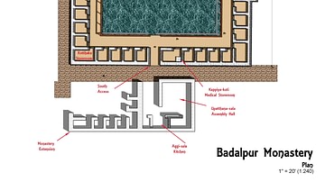
Buddhist Monastery Plan (Gandharan)
Plan of a typical Gandharan Buddhist monastery at Taxila from the site of Badalpur. Dated to 2nd - 5th Cent CE
Image
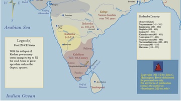
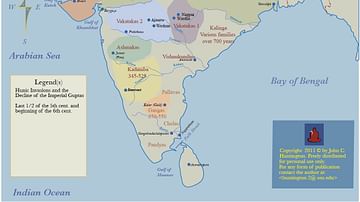
Post Kushan India
A map showing the political situation in the Indian Subcontinent following the fall of the Kushan Empire
Image
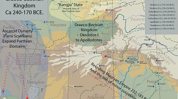
Graeco-Bactrian Empire
The map shows the first Graeco Bactrian kingdom established by Diodotus 1 following the dissolution of the Seleucid Empire. c. 240 - 170 BCE.
Image
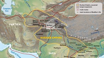
Kushan Empire
The map shows the extent of the Kushan Empire, c. 100 - 240 CE.
Image
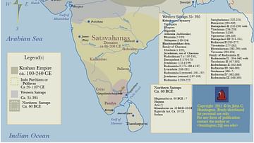
Kushan Empire & Neighboring States
This map shows the extent of the Kushan empire along with the various states and kingdoms that surrounded it at roughly the same time period. c. 100 - 240 CE.
Image
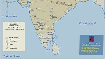
Maruyan Empire
Map showing the extent of the Mauryan Empire at its furthest extent, c. 322 - 185 BCE.
Image
White Hun (Huna) Empire
The map shows the extent of the White Hun empire along with the various rulers as well as the neighboring states.