
Search Images
Browse Content (p. 1580)
Image
Ramesses II Relief
This sandstone temple wall relief depicts the Egyptian pharaoh Ramesses II praying. From Memphis, New Kingdom of Egypt, 19th Dynasty, c. 1250 BCE.
State Museum of Egyptian Art, Munich, Germany.

Image
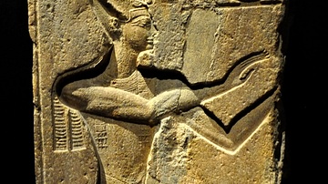
Amun, Ramesses II, & Mut
A granite monument depicting the god Amun, Ramesses II, and the goddess Mut. Dynasty XIX, 1279-1213 BCE. Temple of Amun, Thebes. (Egyptian Museum, Turin, Italy)
Image
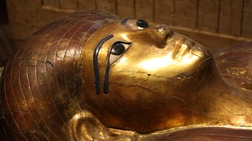
Sarcophagus of Kha (Detail)
A detail of the gilded sarcophagus of Kha, New Kingdom, Dynasty XVIII (1428-1351 BCE). Egyptian Museum, Turin, Italy
Image
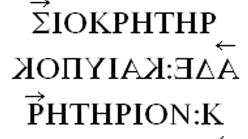
Ancient Greek Boustrophedon Inscription
Example of an Ancient Greek boustrophedon inscription. The arrows indicate the direction of the writing for each line. Non-symmetrical letters change their orientation with the alternate directions of the lines.
Image
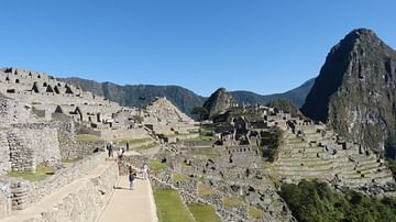
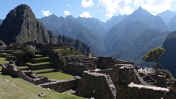
The Slopes of Machu Picchu
The Inca site of Machu Picchu built by Pachacuti Inca Yupanqui (1438-71 CE). Fortress, sanctuary, and once home to around 1,000 residents, the site is perched in the high Andes above the river Urubamba.
Image
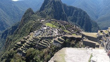
Machu Picchu, Peru
The Inca site of Machu Picchu built by Pachacuti Inca Yupanqui (1438-71 CE). Fortress, sanctuary, and once home to around 1,000 residents, the site is perched in the high Andes above the river Urubamba.
Image
Machu Picchu Panorama
The Inca site of Machu Picchu built by Pachacuti Inca Yupanqui (1438-71 CE). Fortress, sanctuary, and once home to around 1,000 residents, the site is perched in the high Andes above the river Urubamba.
Image
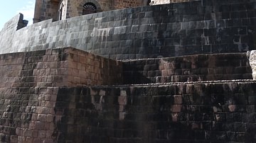
Coricancha Curved Wall
Part of the surviving wall from the Inca sacred precinct of Coricancha at Cuzco, 15th century CE. The site was reused for the monastery of Santo Domingo.

Image
Nestor's Cup
Drinking Cup known as the Nestor's Cup found in the ancient Greek site of Pithekoussai on the island of Ischia in Italy, dated to c. 740 BCE. The cup has letters that are considered one of the oldest known examples of the use of the Greek...
Image
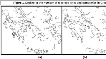
Figure 1 - Decline in the number of recorded sites and cemeteries in Greece
Recorded sites and cemeteries in Greece. (a) LH IIIB period , shows a total of 628 sites and cemeteries. (b) LH IIIC period, shows a total of 147, a reduction of slightly over 75% in the number of recorded sites and cemeteries. (Source...