
Search Images
Browse Content (p. 1682)

Image
Kfar Bar'am Synagogue
The ruins of the 3rd century CE synagogue at Kfar Bar'am, northern Israel.

Image
Euclid of Alexandria
An illustration of Euclid of Alexandria, the 4th century BCE mathematician.

Image
Bust of Marcus Annaeus Lucanus
Bust of the Roman poet Marcus Annaeus Lucanus (CE 39-65). Grandson of Seneca the Elder and nephew of Seneca the Younger, was a Roman statesman and Latin poet. The sculpture can be found in his birthplace, Corduba (modern...

Image
Depiction of Metonic cycle
Depiction of the 19 years of the Metonic cycle as a wheel, with the Julian date of the Easter New Moon, from a 9th-century computistic manuscript made in St. Emmeram's Abbey.
Image
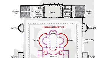
Plan of Hadrian's Library
A plan of the Library of Hadrian, Athens. c.132-134 CE. Later churches constructed at the centre of the complex are also indicated.
Image
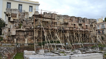
Library of Hadrian, East Wall
The Library of Hadrian in Athens showing the eastern end wall of the peristyle court. The room with the niches (now under scaffolding) would have been the library proper, where ancient scrolls were stored. c. 132-134...
Image
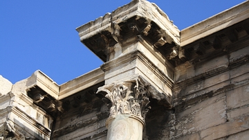
Capital, Library of Hadrian
A Corinthian capital from the north facade of the Library of Hadrian, Athens. c. 132-134 CE
Image
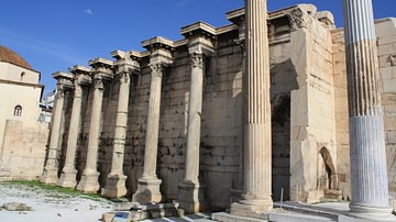
Facade, Library of Hadrian, Athens
The north facade of the Library of Hadrian, Athens. c. 132-134 CE

Image
Attic Calendar
Fragments of Attic Calendar re-used in the church facade. According to Deubner first Thargelion, then Gemini, then Skirophorion, then the sacrifice of an oxen at the Dipolieia, then Cancer, then Hekatombaion, then a personification...

Image
Invasions of the Roman Empire
A map illustrating the various invasions suffered by the Western Roman Empire between 100 and 500 CE.
