
Search Images
Browse Content (p. 1688)
Image
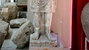
Statue of Priest Bano Abdo from Hatra
Statue of the priest Bano Abdo from Hatra. The statue’s base is inscribed with an Aramaic text. The man has a long beard and an upward-curling mustache. He looks forward and wears a long conical hat. His hands (now lost) would have held a...
Image
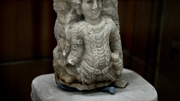
A Warrior God from Hatra
Only the upper part of this alabaster slab has survived. It depicts a male figure in relief, represented en face, very probably a warrior god, holding his sword's hilt with his left hand. He wears a necklace and there are two braids of hair...
Image
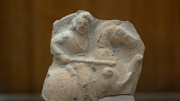
Knight from the Hellenistic Period
This is a fragment of a terracotta plaque, which depicts a knight riding a horse. He holds a sword with his right arm. From Mesopotamia, Iraq. The Hellenistic period, 334-139 BCE. (The Sulaymaniayh Museum, Iraq)
Image
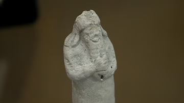
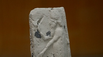
A priest from Assyria
This terracotta statuette depicts a standing man who has a long hair and beard. Both of his hands are clenched; the right one is on the left. He seems as if he is holding something within this hands. From Mesopotamia, Iraq. Neo-Assyrian period...
Image
Apkallu plaque
This terracotta plaque depicts an Apkallu. The figure is standing and wears a fish cloak. His right hand is raised and holds a cone while the left hand holds a bucket. Neo-Assyrian period, 911-609 BCE. From Mesopotamia, Iraq. The Sulaymaniyah...
Image
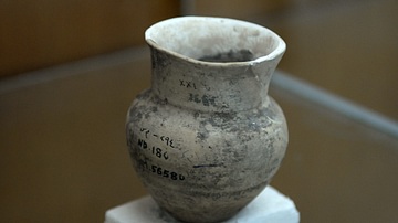
Pottery from Nimrud
This pottery was found in the city of Nimrud (the Assyrian capital), northern Mesopotamia, Iraq. Note the writings and acquisition numbers on it. Neo-Assyrian period, 911-609 BCE. From Mesopotamia, Iraq. The Sulaymaniyah Museum, Iraq.
Image
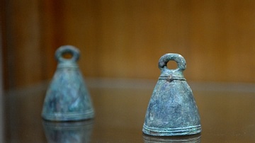
Assyrian Bells
These two bells were found in northern Mesopotamia. Neo-Assyrian period, 911-609 BCE. From Mesopotamia, Iraq. (The Sulaymaniyah Museum, Iraq)
Image
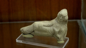
Hellenistic Woman
This terracotta statuette depicts a woman. The woman is recumbent but she is not naked. She looks forward, as if she is talking to someone or looking at something. She put her right arm on her right thigh but she holds something with her...
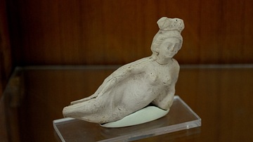
Image
Woman from the Hellenistic Period
This terracotta statuette depicts a woman. The woman is recumbent and is naked and wears an elaborate headdress. She looks forward, as if she is talking to someone or looking at something. From Mesopotamia, Iraq. The Hellenistic period, 334-139...

Image
Aegeus Consults the Oracle at Delphi
Themis and Aegeus. Attic red-figure kylix, from Vulci, 440-430 BCE.
Antikensammlung, Altes Museum, Berlin, Germany.