
Search Images
Browse Content (p. 1692)

Image
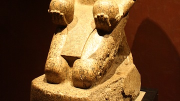
Lefkandi Centaur
Terracotta sculpture found on the site of Lefkandi (Euboea), dated to c. 950 BCE (Archaeological Museum of Eretria).
Image
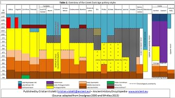
Table 2 - Overview of the Greek Dark Age pottery styles
Overview of the different pottery styles found in Greece between 1050 BC to 700 BC.
Image
Amenhotep II
Granite statue of Amenhotep II, Dynasty XVIII (1427-1401 BCE). From the temple of Amun, Thebes. Amenhotep holds two spherical wine vessels in offering to the god Nu. (Egyptian Museum, Turin)
Image
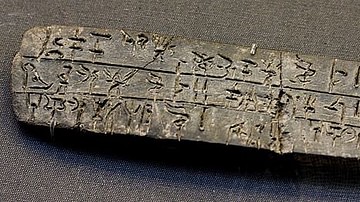
Linear B Clay Tablet
Example of a Linear B clay tablet found at Knossos. It records quantities of oil apparently offered to various deities.

Image
Cerdic of Wessex
Cerdic of Wessex from the 2004 movie "King Arthur". Image Guardian Unlimited: http://www.theguardian.com/film/pictures/image/0,8545,-10704979171,00.html.

Image
Epictetus
An artistic impression of the Greek Stoic philosopher Epictetus. Engraved frontispiece of Edward Ivie’s Latin translation (or versification) of Epictetus’ Enchiridon, printed in Oxford in 1751 CE.

Image
Hoplite Warrior, Dodona
The bronze statuette from Dodona depicting a hoplite warrior.

Image
Theatre of Dodona
The theatre of Dodona, 3rd century BCE.
Image
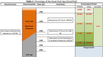
Table 1 - Chronology of the Greek Dark Age
Simplified chronology of the Greek Dark Age
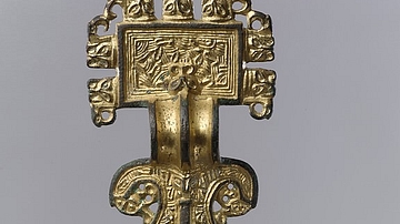
Image
Saxon Square-Headed Bow Brooch
Saxon Square-Headed Bow Brooch, Anglo-Saxon, 6th century CE, Metropolitan Museum of Art.