Search Images
Browse Content (p. 1699)

Image
Hellenistic Trade Routes, 300 BCE
Alexander the Great died in Babylon on the 13th of June, 323 BCE. His Macedonian-Greek empire broke apart, but Alexander’s heritage was felt throughout the ancient Mediterranean world for centuries. Three Hellenic empires emerged from the...

Image
Greek and Phoenician Colonization
Both the ancient Greeks and Phoenicians extensively colonized vast areas of Europe, along the Mediterranean and Black Sea coasts. In doing so, they spread their culture, which strongly influenced the local tribes. For the Greeks, this is...
Image
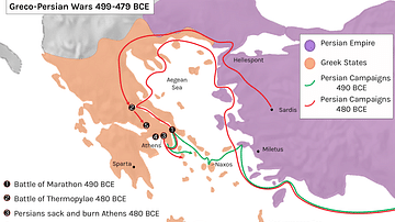
Greco-Persian Wars
The Greco-Persian Wars or Persian Wars were a series of battles in the 5th century BCE between Greece and Persia. This series of wars consisted of some famous battles; Marathon, Thermopylae, Salamis and Plataea which resulted in a Greek victory...

Image
Ancient Egypt
Map of Ancient Egypt, showing the Nile up to the fifth cataract, and major cities and sites of the Dynastic period (c. 3150 BC to 30 BC). Cairo and Jerusalem are shown as reference cities.
Image
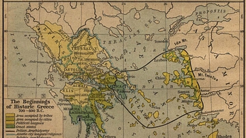
The Beginnings of Historic Greece
The Beginnings of Historic Greece. 700 - 600 B.C.
Image
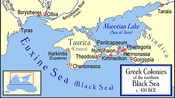
Greek Colonies of the Northern Black Sea
Map showing Ancient Greek colonies on the northern coast of the Black Sea, c. 450 BC.
Image
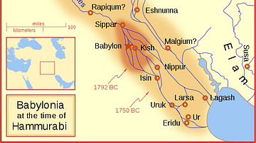
Babylon at the time of Hammurabi
A locator map of Hammurabi's Babylonia, showing the Babylonian territory upon his ascension in 1792 BC and upon his death in 1750 BC. The river courses and coastline are those of that time period — in general, they are not the modern rivers...
Image
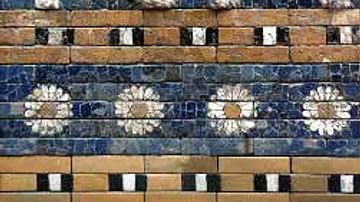
Detail of the Ishtar Gate
Detail of the Ishtar-Gate : a lion, symbol of the goddess Ishtar.
Image
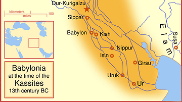
Babylon at the time of the Kassites
A map of the Babylonian Empire during the time of the Kassites, roughly the 13th century BC. This map shows the probable river courses and coastline at that time.
Image
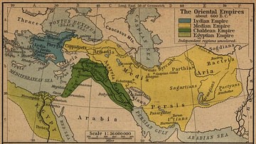
The Oriental Empires
Map showing the Median, Lydian, Chaldean, and Egyptian empires around 600 BC.