Search Images
Browse Content (p. 1732)

Image
Laomedon (Temple of Aphaia)
The Trojan king Laomedon(?) from the east pediment of the Temple of Aphaia on Aegina (c. 490-480 BCE). The scene is thought to depict Hercules' attack on the city of Troy. (Glyptothek, Munich).

Image
Antonine Wall
On the north-west frontier of the Roman Empire, the Antonine wall was built c. 140 CE on the orders of Antoninus Pius. The wall stretched from the Firth of Forth to the Clyde estuary.

Image
The Diskobolos (Discus Thrower)
The Diskobolos or Discus Thrower, 2nd century CE. Roman copy of a 450-440 BCE Greek bronze by Myron recovered from Emperor Hadrian's Villa in Tivoli, Italy. (British Museum, London)
Image
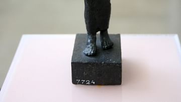
Bronze Aulos Player Figurine
The man wears a long tunic and mantle. From his left shoulder hangs an instrument case. The straps for the instrument can also be seen, tied around the mouth and cheeks.
From a Corinthian workshop, 500- 490 BC
Delphi Museum
Image
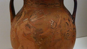
An Aulos Player and Dancing Girl
This Attic red-figure vase depicts an aulos player accompanying a female dancer. There is a kithara suspended in between them.
National Archaeological Museum 1187
Image
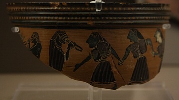
Aulos Players and Dancers
Fragment of a black-figure pyxis or skyphos. Depicted are dancing women accompanied by aulos players.
Brauron Museum
Image
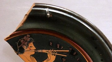
Aulos Player
This fragment of an Attic red-figure plate depicts an aulos player, and clearly shows the strap which was worn to aid the playing of the instruments. The inscription says, "Hermocrates did this" National Archaeological Museum, Athens...
Image
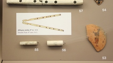
The Brauron Aulos
no. 57 shows the Brauron aulos, found at excavations at the temple site of Brauron in a holy pond. It is made of bone and dated to the end of the 6th C. - 5th C. No.s 55 + 56 are fragments of an aulos No.s 53 + 54 show two aulos players...
Image
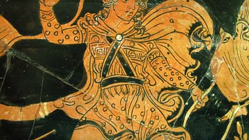
Orpheus
A detail from an Apulian red-figure bell krater by the Pronomos Painter. First quarter of the 4th century BCE. Depicted is Orpheus in Thracian dress defending himself against Maenads(?). (Taranto, Museo Nazionale Archeologico, temporary loan...

Image
Mandrake
Mandrake (Mandragora officinarum), scanned from 15th century manuscript Tacuinum Sanitatis.