
Search Images
Browse Content (p. 1743)
Image
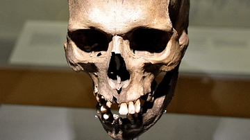
The Clachaig Skull
This skull was excavated from the cairn of Clachaig Falls on Arran in 1900 CE. With this skull, the skeletons of 14 men, women, and children were also discovered. The skull belonged to a young adult male; he was probably a farmer. Neolithic...
Image
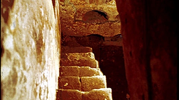
The Columbarium at the Villa Wolkonsky, Rome
Before entering this columbarium, which is in the garden of the residence of the British Amabassador to Italy, I had to sign a waiver to the effect that I would not hold HM Government responsible for any mishap. And from the state of the...
Image
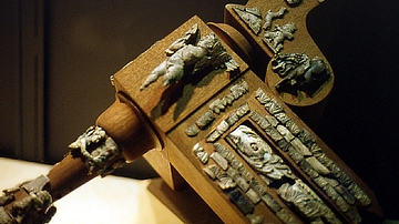
Cremated Ivory Cupids from a Funeral Couch, Rome
After cremation, the incinerated bones were picked out and sorted from the charred wood of the fire and the couch on which the body had been laid. While the bones would be collected and placed into an urn, the remains of the wood and couch...

Image
Poseidon, Silver Tetradrachm of Macedon
Silver tetradrachm from Macedon, 306-283 BCE.
Obverse: Nike
Reverse: Poseidon
Alpha Bank Numismatics Museum, Kerkyra, Corfu.
Image
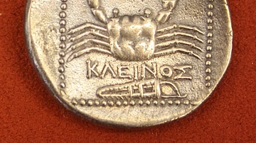
Silver Tetradrachm, Kos
A silver tetradrachm from Kos, 300-190 BCE. O: Hercules, R: Crab. (Alpha Bank Numismatics Museum, Kerkyra, Corfu)

Image
Silver Stater, Metapontum
Silver stater from Metapontum, 520 BCE. O: Ear of wheat, R: same incuse. (Alpha Bank Numismatics Museum, Kerkyra, Corfu)
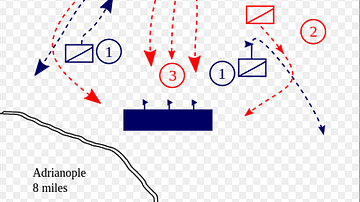
Image
Battle of Adrianople 378 CE
Battle of Adrianople, 378 CE.
Image
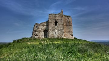
Bukelon (Matochina) Fortress
Bukelon Fortress ruins, Thrace (modern-day Bulgaria), ruins from the 12-14th century CE. This site was mentioned in reports from the Battle of Adrianople in the 4th century CE.
Image
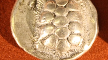
Silver Stater, Aegina
Silver stater from Aegina, 4th century BCE. O: Tortoise, R: Incuse square. (Alpha Bank Numismatic Collection, Kerkyra, Corfu)

Image
Apollo, Macedonian Gold Stater
Macedonian gold stater, 359-336 BCE.
Obverse: Apollo
Reverse: Charioteer
Alpha Bank Numismatics Collection, Kerkyra, Corfu.