
Search Images
Browse Content (p. 1751)
Image
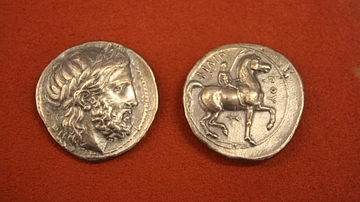
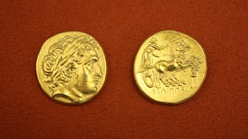
Philip II, Macedonian Silver Tetradrachm
Macedonian silver tetradrachm from the reign of Philip II, 359-336 BCE. O: Head of Zeus. R: Horseman carrying a palm branch.
Image
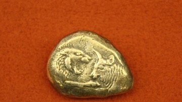
Lydian Silver Stater
Lydian silver stater from the reign of Croesus, 560-546 BCE. O: Foreparts of a lion and ox. (R: Two incuse squares).
Image
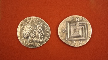
Cretan Silver Tetradrachm
Silver tetradrachm from Knossos, Crete, 2nd or 1st century BCE. O: Head of Zeus. R: Labyrinth.
Image
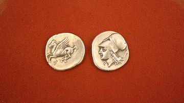
Pegasus & Athena, Corinthian Silver Stater
Silver stater from Corinth, 386-307 BCE. O: Pegasus. R: Head of Athena.
Image
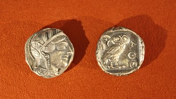
Athenian Silver Tetradrachm
Silver tetradrachm from Athens, 479-454 BCE. O: Head of Athena. R: Owl and olive branch.
Image
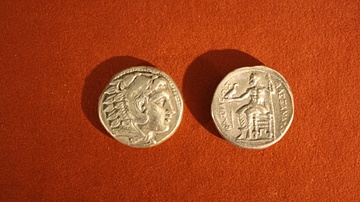
Alexander the Great, Macedonian Silver Tetradrachm
Silver tetradrachm from the reign of Alexander the Great, 336-323 BCE. O: Head of Hercules. R: Zeus seated on a throne holding an eagle.
Image
Macedonian Gold Stater
Macedonian gold stater from the reign of Philip II, 359-356 BCE. O: Head of Apollo. R: Charioteer driving a racing biga.
Image
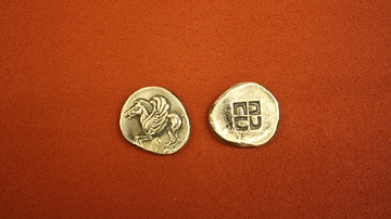
Pegasus & Swastika, Corinthian Silver Stater
Silver stater from Corinth, 525-500 BCE. O: Pegasus. R: Incuse square of swastika design.
Image
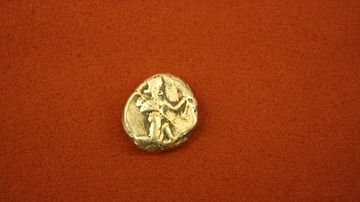
Persian Silver Siglos
Silver siglos from Persia, kingdom of Achaemenids, 5th-4th century BCE. O: King with bow and quiver. R: Incuse oblong.
Image
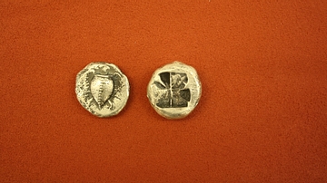
Aegina Silver Stater
Silver stater from Aegina, 550-500 BCE. O: Sea turtle. R: Incuse square with eight sections.