
Search Images
Browse Content (p. 1772)
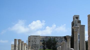
Image
Roman Agora in Tyre
Roman Agora (believed to be) at Al Mina excavation area.
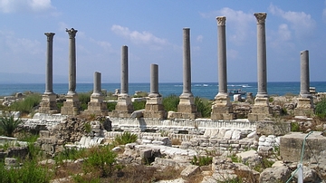
Image
Palaestra in Tyre
Columns of what is believed to be Palaestra (athletes' training area) at the Al Mina excavation area in Tyre.
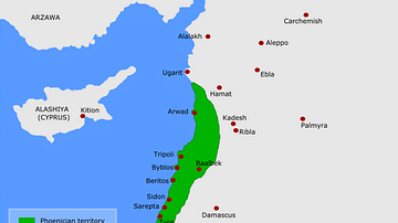
Image
Map of Phoenicia
A map of ancient Phoenicia with important cities.
Image
Hadrian's Wall Gate
The North Gate of Housesteads Fort on Hadrian's Wall. Passport control, immigration control and customs check all in one place. The wall was a checkpoint for taxing cross-border trade as well as a defence.
Image
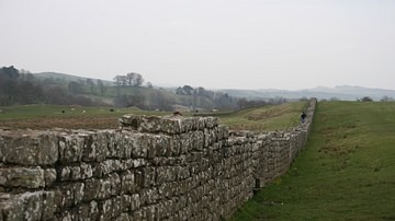
Hadrian's Wall
A section of Hadrian's Wall near Carlisle.
Image
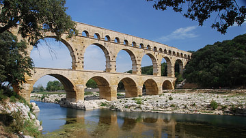
The Roman Aqueduct of Pont du Gard
The Pont du Gard is an aqueduct in the South of France constructed by the Roman Empire, and located in Vers-Pont-du-Gard near Remoulins, in the Gard département. It has long been thought that the Pont du Gard was built by Augustus' son-in-law...
Image
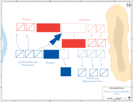
Battle of Chaeronia
A map illustrating the battle of Chaeronia.
Image
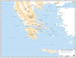
Map of Classical Greece
A map showing classical Greece and the Aegaean islands.
Image
Map of Persia and the March of the Ten Thousand
A map of Persia, indicating major settlements, regions, and mountain ranges, as well as the march of the Ten Thousand (dotted line). The Ten Thousand were a group of mercenary units, mainly Greek, drawn up by Cyrus the Younger to attempt...
Image
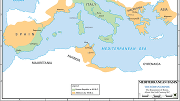
Map of 2nd Century Roman Expansion
A map showing the early expansions of Rome, in the 2nd century BC.