
Search Images
Browse Content (p. 1785)
Image
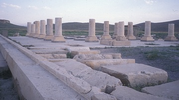
Pasargadae Audience Hall
The audience hall of the royal palace in Pasargadae.
Image
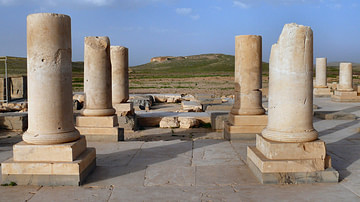
Pasargadae Palace
Cyrus the great's private palace at Pasargadae. This palace is one of the two first builded in the emerging capital of the founder of the new persian empire. Before Pasargadae, the persian who were nomadic shepperds, had no real architectural...
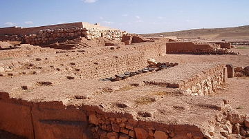
Image
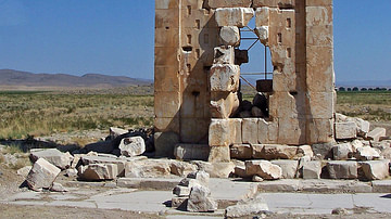
Prison of Solomon
The so-called Prison of Solomon (Zendan-i Suleiman), Pasargadae, Iran. A fire temple, a tomb or a depository, this now-fragmentary construction continues to defy secure interpretation.
Image
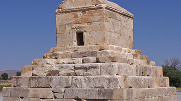
Tomb of Cyrus
Burial place of Cyrus the Great (d. 530 BCE) of the Persian Achaemenid Empire. Pasargadae World Heritage Site, modern-day Iran.
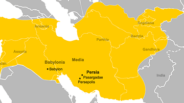
Image
Empire of Cyrus the Great
The Achaemenid Empire during the reign of Cyrus the Great, 559 BCE-530 BCE. Major cities are marked and modern borders are superimposed.
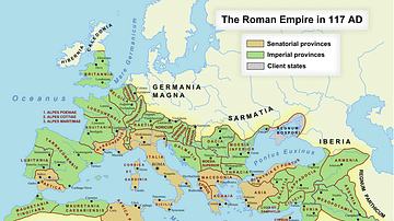
Image
Roman Empire in 117 CE
Map of the Roman Empire at its maximum extent in 117 CE, under the rule of Trajan.
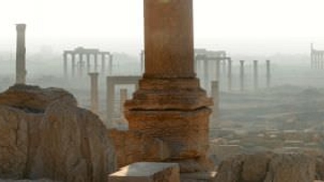
Image
Panorama of Palmyra
A panoramic view of ruins of the ancient desert city of Palmyra in Syria, which grew large in the Syrian desert in the 1st and 2nd centuries AD.
The ruins are now a United Nations World Heritage site.
Image
Ruins of Ebla
The image shows part of the excavated city of Ebla in Syria. Most of the ruins have been given a top layer of new bricks. Some stones used to grind flour are also seen in the picture.
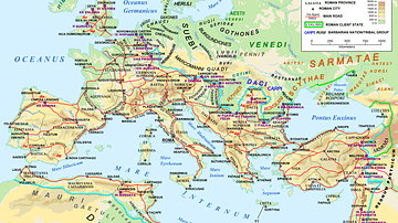
Image
Map of the Roman Empire in 125 CE
A map of the Roman Empire and Europe in 125 CE, at the time of Roman emperor Hadrian.
"Barbarian" names and locations are given as found in the works of Tacitus (written c. 100 CE).
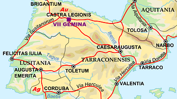
Image
Map of the Iberian Penninsula in 125 AD
A map showing Iberian peninsula in 125 AD including important roads, locations of legions and gold (Au) and silver (Ag) mines.