
Search Images
Browse Content (p. 1803)
Image
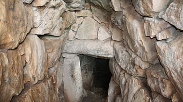
Fountain Entrance, Mycenae
The inner entrance to the stepped tunnel (1200 BCE) which descends 18 metres to a subterranean well. The well is supplied via a stone aqueduct from a spring east of the citadel.
Image
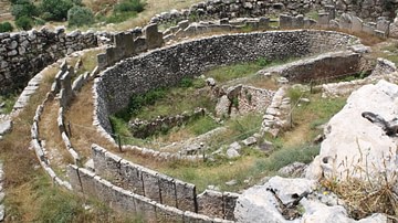
Grave Circle A, Mycenae
The royal grave circle within the walls of Mycenae (1600 BCE). It was in the shaft graves here that Heinrich Schliemann discovered in 1876 CE the famous gold death mask attributed (incorrectly) to King Agamemnon.
Image
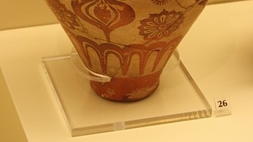
Mycenaean Jug
Mycenaean bridge-spouted jug displaying a Minoan influence (1500-1450 BCE). Found in the Kalkani tomb, Mycenae. Archaeological Museum Mycenae.
Image
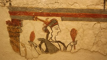
Mycenaean Fresco
Mycenaean fresco from Mycenae (1250-1180 BCE). Archeaological Museum Mycenae.

Image
Treasury of Atreus, Mycenae
Mycenaean tholos tomb at Mycenae (1450 BCE).
Image
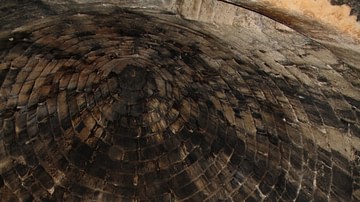
Interior Ceiling, Tholos of Mycenae
The interior ceiling of the 'Treasury of Atreus', tholos tomb (1450 BCE), Mycenae.
Image
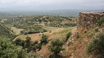
Citadel of Mycenae
The view to the south from the upper citadel of Mycenae looking towards Argos (1350 BCE).
Image
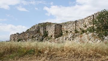
Tiryns
Tiryns was a major Mycenaean centre, the magnificent walled fortifications visible today date from the 13th century BCE. The large size of the stones of the walls led the ancient Greeks to believe they were the work of the Cyclopes.
Image
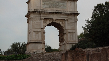
Arch of Titus
The arch of Titus in the Forum Romanum
Image
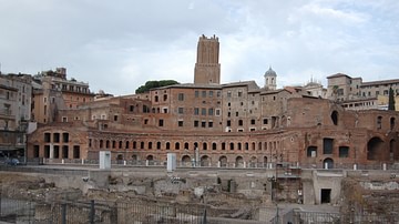
Trajans Market
Remains of Emperor Trajan's market in the ruins of the imperial forums.